Posts Tagged ‘reserved lanes’

h1

Officials boost roads and “Super BRT”, put urban rail on side track

31 August 2017

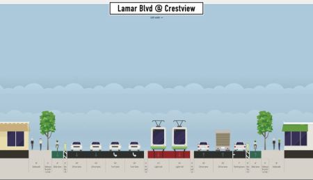
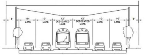
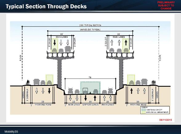
Cross-section of one version of TxDOT’s plan for massive rebuild and expansion of I-35. Center tolled “express” lanes (at bottom center of diagram) are proposed for use by “Super BRT” project to be funded and operated by Capital Metro. Graphic: Mobility35. (Click to enlarge.)

Commentary by David Orr

David Orr, an Austin community activist involved with transportation issues, is a longtime environmental justice and transportation advocate.

Last month, on July 26th, Capital Metro’s Project Connect, together with several other regional agencies, sponsored another of their “Traffic Jam” community meetings to discuss possible options in the planning process. This mainly consisted of a panel of professionals and officials, some local, and some from elsewhere in the country, sitting on a stage in a chapel at Huston-Tillotson University explaining different transit issues to the audience.

I attended this event, but was extremely disappointed in what I saw for a number of reasons. For one, the talking heads were allowed to go over their allotted time (typical for politicians and agency officials), leaving only a half-hour of the two and a half hours of the originally scheduled event time for audience participation. This common practice is designed to minimize public input and maximize officials’ output (i.e., a PR effort).


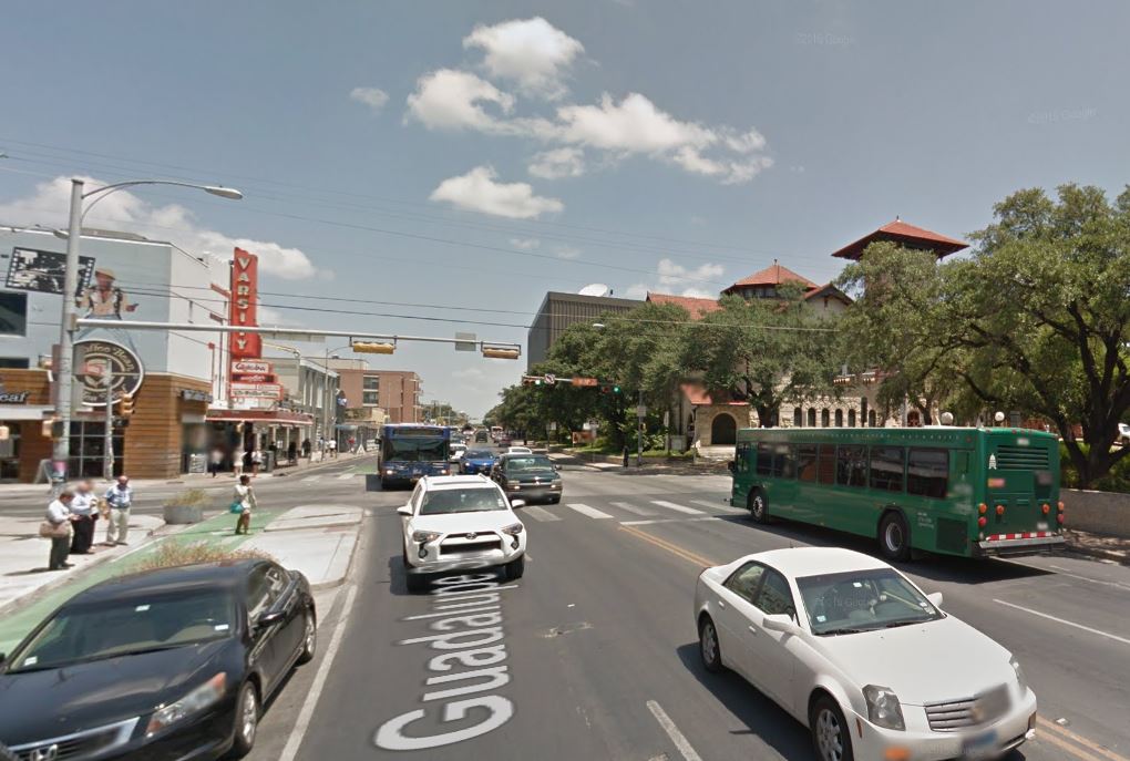
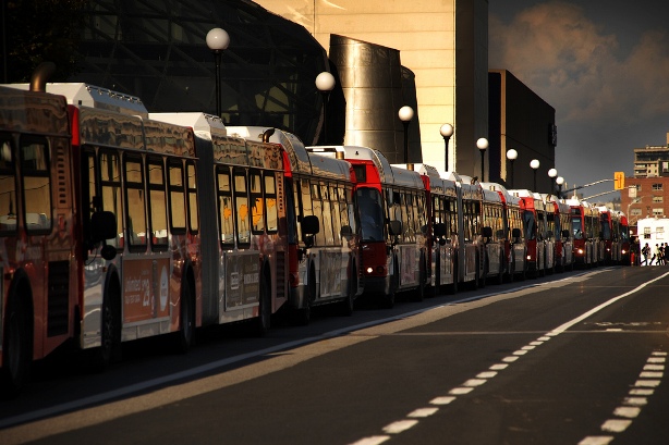
Project Connect-sponsored “Traffic Jam” meeting on July 26th at Huston-Tillotson University. Opportunity for audience participation was truncated. Photo: L. Henry.


More importantly to our concerns, as was the case with the April “Traffic Jam”, the politicians never got specific about mass transit and talked instead mostly about how expensive transit is and how little money they have. At the same time they have been touting how much good they’re doing building new road capacity with the 2016 bond issue.

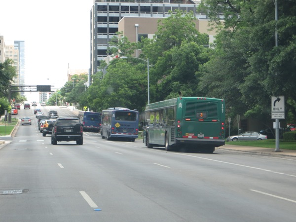
Capital Metro’s blog post on the recent “Traffic Jam” added little of substance, but in truth there was little offered by the consultants and local officials, so not much to report on. This event could have been much more effective had there been discussion of Austin’s specific needs, rather than dwelling on reports of what worked in other cities. There was no mention from the stage of what kind of new transit should be built here – and where. That was a glaring omission in the program agenda. It seemed a clear message that they’re seeking public (written) comment of the kind where officials will not be required to respond with any specificity, much less take a stand for or against. I hope I’m wrong, but to date the only messages we’ve received indicating openness to specific forms of new transit initiatives relate to what they’re calling “Super BRT” as if it were a done deal.

The “Super BRT” idea has been brought to public attention only within the last couple of months, bypassing Project Connect’s ongoing “high-capacity transit” study. A June 27th article by Caleb Pritchard in the Austin Monitor cited information from Capital Metro’s vice president of strategic planning and development, Todd Hemingson:

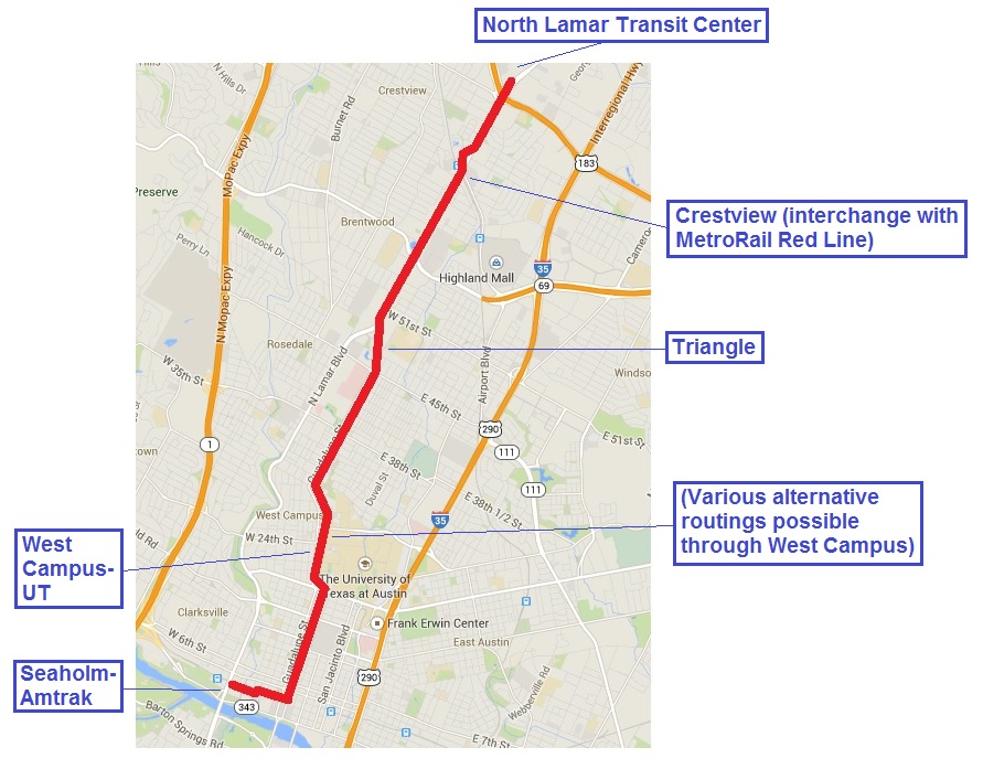
… Hemingson told reporters that the agency has been talking with TxDOT for five years about the I-35 bus rapid transit plan. The department is planning a $4 billion overhaul of the highway and appears to be open to the agency’s insistence that the project include some dedicated allowance for transit. The formative vision for the bus rapid transit system includes a handful of stations built on bus-only lanes in the median of the interstate. Those stations, Hemingson said, would be paired with frequent-service bus routes on intersecting east-west corridors.

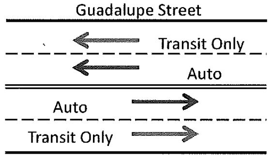
This “Super BRT” is really a “pseudo BRT” plan, since the buses would run with mixed traffic in HOV toll lanes (“HOT lanes”). Basically, it seems like just another express bus system with some added improvements.

At the July 26th “Traffic Jam” I was particularly disturbed by a glossy brochure being distributed from Capital Metro titled Connections 2025, which laid out in very concrete terms the agency’s “vision” for the next five years. Nowhere in this document was any rail expansion even mentioned as a possibility. In contrast, the I-35 “Super BRT” plan was mentioned twice, in both places identifying it as if it’s already approved as a project in line for implementation.


Capital Metro’s Connections 2025 brochure includes “Super BRT” as an assumed project. Graphic: CMTA. (Click to enlarge.)


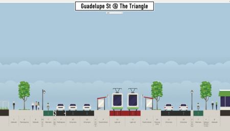
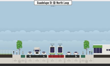
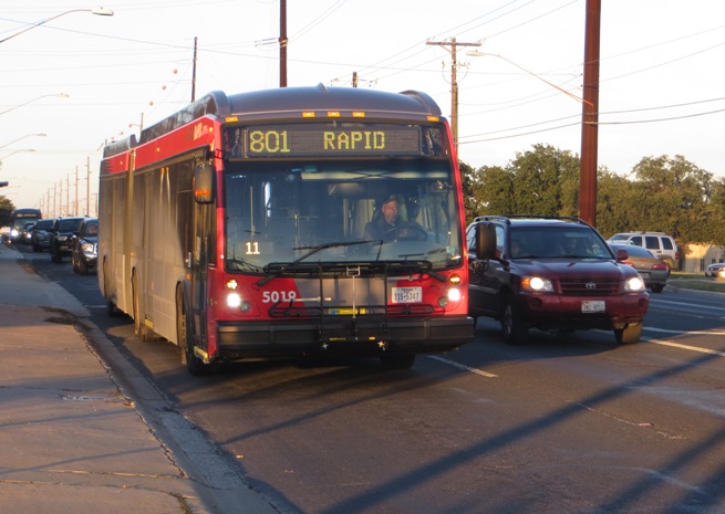
There was no discussion at all of this “Super BRT” project on I-35 during any of the many presentations and speeches during the program, and the very abbreviated public Q&A at the meeting did not permit me to ask for clarification. The only mention in this document of the Guadalupe-Lamar corridor was the continued development and expansion of MetroRapid 801 as well as 803 and additional routes. If they intend to continue to dump cash on the “rapid bus” projects in this corridor, that would effectively preclude serious discussion of a light rail transit (LRT) project in that corridor within the next decade at least.

In the Connections 2025 brochure, the “Super BRT” project was listed on the agency timeline for completion by 2023. Needless to say, it looks like the fix is in, at least as far as Capital Metro is concerned. However, I did ask a Project Connect staffer whether this was now a foregone conclusion, and he insisted it’s not. He also said that LRT is still on the table, but admitted that no one at the agency is really discussing it. That was an eye-opener.

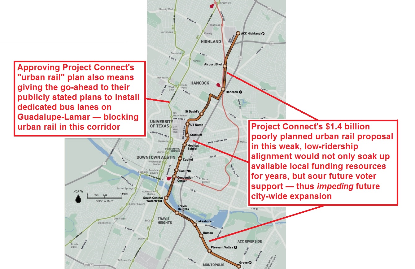
Clearly this is a major challenge to those of us – transit advocates and a large contingent of neighborhoods and other community members – who have been backing LRT in Guadalupe-Lamar (G-L). Perhaps It’s time to request Capital Metro’s board for clarification on their plans for “Super BRT” and how their public input supports this major investment. Especially in view of the fact that this carries a huge opportunity cost for alternatives that might include LRT anywhere else in the city, much less on the G-L route. It’s clear that Capital Metro has been intentionally avoiding responding to the continuing public input they’re receiving in support of LRT and the lack of public support for this “Super BRT” notion.

It may also be necessary at some point to bypass Capital Metro and take this directly to the City Council. Council can make this happen even if they have to drag the transit agency off the “Super BRT” express bus.

However, there are other factors in play that may take the air out of the tires of this scheme. A July 24th article by Ben Wear in the American-Statesman quotes a TxDOT spokesperson regarding the request for money from Capital Metro for in-line stations on I-35. The TxDOT representative insists that “as far as financing goes, none of our funding sources will cover transit.”

Based on my reading of this news report, it seems TxDOT has given Capital Metro a clear signal that “Super BRT” will only happen if the transit agency pays for it. In the current situation, that’s actually very good news from the standpoint of proper planning and what kind of major transit improvement Austin truly needs – LRT.

If Capital Metro can’t raise the funds on its own to build this “Super BRT” – or even some scaled-back version of it – that will likely be the end of that bad dream. Presumably its proponents would have to get some bond money to fund it, but if that had to go before the voters it could turn out like the Prop 1 debacle which failed because the public support just wasn’t there. Capital Metro’s credibility would be pretty much destroyed. So maybe there is hope for a G-L LRT after all. From a politics standpoint, it’s usually easier to kill something controversial than it is to approve it.

A small but vocal opposition armed with facts could probably sink “Super BRT” if it came to a bond election. I suspect that politically aware members of Capital Metro’s board would be sensitive to sustained expressions of support for G-L LRT, and if there’s no evident support for Super BRT they may respond accordingly, if reluctantly.

We have every reason to doubt that Capital Metro will even be able to come close to providing the money demanded by TxDOT to build the “Super BRT” line, at least to whatever standards Capital Metro may determine will have a ghost of a chance in reaching reasonable ridership numbers. This would be a situation where the lack of agency funding could actually work to the benefit of truly effective transit – i.e., an urban rail alternative.

In any case, approval of G-L LRT will itself require a public vote. Nevertheless, supporters of this long-overdue project have good reason to believe it will pass if we can bring strong public support to the cause. We’ll have to win an election, and we need to start strategizing now.

My hunch is that funding “Super BRT” will kill off LRT for the next decade. Conversely LRT could do in this pseudo-BRT project. It’s a zero-sum game. So long as BRT is getting all the official attention our side is side-lined in the public’s eyes.

It’s been pointed out here that the likelihood of funding I-35 “Super BRT” through a public bond vote would be much less likely than is the case with LRT, which would run where people actually live and work. One of our most potent arguments is that high ridership depends on convenience and flexibility in options for future build-out/expansion. Yet “Super BRT” on I-35 is just a one-trick route, with few options for east-west routes. In contrast, LRT of course has many possibilities for eventual expansion.


Rendition of LRT on Drag from 2000. Graphic: Capital Metro, via Light Rail Now.

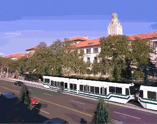
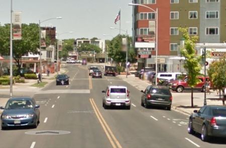
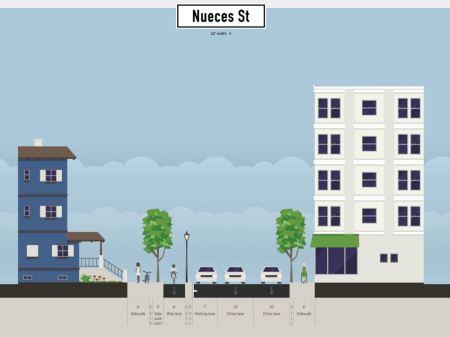
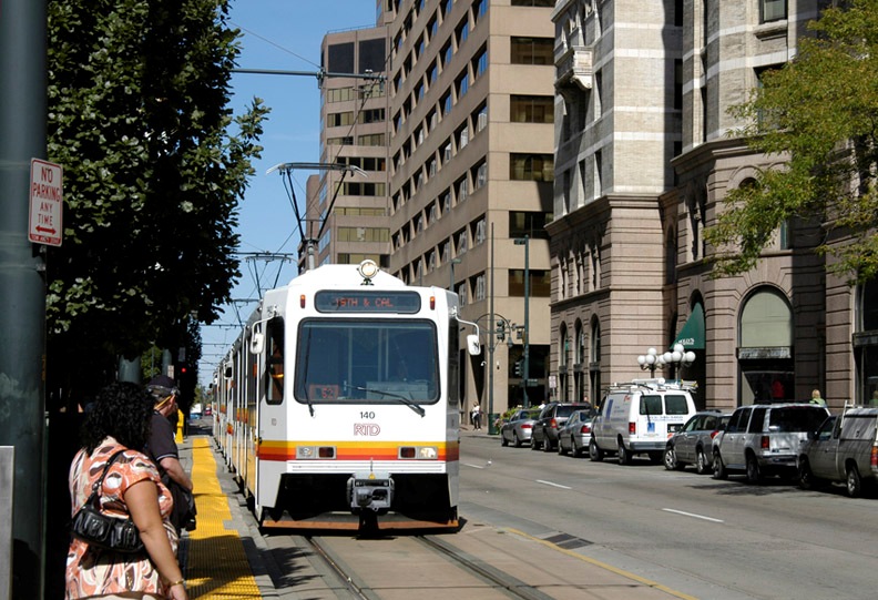
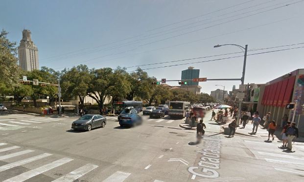
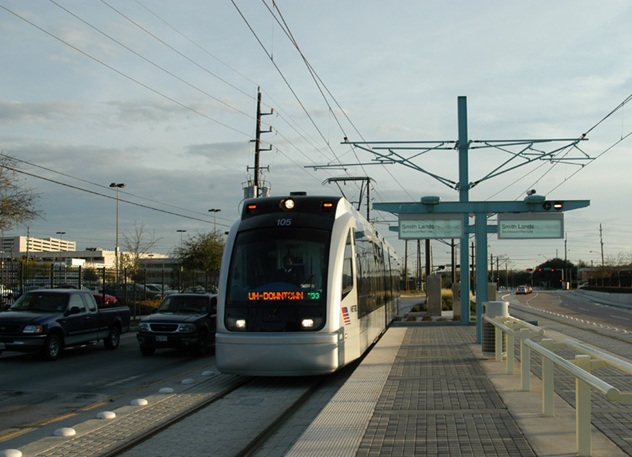
Rendition of LRT passing UT campus on Guadalupe St. An initial starter line in Guadalupe-Lamar corridor would provide basic urban rail backbone for expansion into a citywide system. Graphic: Capital Metro, via Light Rail Now.


This is the sort of discussion that Capital Metro should be facilitating as part of the Project Connect planning process. One bright spot I have seen recently in the process is the agency’s stated intention to respond on their website to written comments. This is an opportunity to find out how responsive the agency is to public interest and demands for specific proposals. At least Capital Metro has not so far ruled out anything.

Thus it is up to pro-rail transit advocates to submit written comments. It’s critical that the written public record reflect the breadth and depth of support for options on the table for consideration. Strong and persistent demonstrations of support for a G-L LRT starter line project may persuade Capital Metro to rethink some of their assumptions and give supporters of this plan a fair hearing, and a detailed response.

This would also be helpful in familiarizing more Austinites with the G-L LRT plan and the case that can be made on its behalf. Advocates of LRT – including the starter line LRT project in the Guadalupe-Lamar corridor – have sufficient expertise and numbers behind this proposal to present a credible and persuasive concept that will be difficult to dismiss.

So long as positive expressions of support are received the transit agency must recognize the breadth and depth of support for urban rail. Hopefully some official heads can be persuaded.

Advertisement
h1

Urban Rail on Guadalupe-Lamar, Not I-35 “BRT”

31 July 2017

Map from Austin Rail Now/Our Rail leaflet distributed at July 26th “Traffic Jam” shows 21-mile light rail transit line proposed as a “high-capacity transit” alternative to the “BRT” line in I-35 advocated by TxDOT and other road proponents.

As our April 30th article «Reorganized Project Connect 2.0 opens up, reaches out» explained, Project Connect – the major planning effort -sponsored by Capital Metro, has been re-evaluating Austin-area corridors as possible candidates for rail and other forms of “high-capacity transit”. In recent months, the Texas Department of Transportation (seeking funding participation for its planned overhaul of Interstate Highway 35 through Austin) has been prodding the transit agency to allocate funding for a so-called “bus rapid transit” (BRT) service to be installed in the proposed reconstructed highway. This has become one of the de facto “high-capacity transit” alternatives competing with urban rail in the Guadalupe-Lamar corridor for major local funding.

On July 26th, Project Connect, Capital Metro, and several other collaborating agencies sponsored a “Traffic Jam” community meeting, with invited panelists, to discuss possible options in the planning process. The following article is adapted from a leaflet published and distributed by Austin Rail Now, together with the Our Rail political action committee, at the “Traffic Jam” meeting, focusing on a proposed central 21-mile light rail transit (LRT) project, paralleling I-35 and Loop 1 (“MoPac”, Austin’s other north-south freeway), as an alternative to the I-35 “BRT” proposal.


Why not a true mobility option?

Alternative to I-35 and Loop 1 — A 21-mile urban rail line, running from Tech Ridge in the north to Southpark Meadows in the south, following the Loop 275 (North Lamar to South Congress) corridor, could provide alternative traffic relief to Austin’s major north-south freeways (I-35 and Loop1/MoPac).

Map at left illustrates the major neighborhoods and activity centers that would be served. Such a route could plausibly have a potential of attracting ridership of 100,000 a day.

Better option than I-35 “BRT” — Urban rail is a far better public transit option than a dubious, seriously handicapped “bus rapid transit” (BRT) line in I-35. Urban rail lines have demonstrated significantly greater potential to attract riders, guide adjacent development, improve commercial taxbase, and stimulate economic activity. It’s unlikely that buses running in an I-35 HOV toll lane would yield any of these benefits.

Affordable — Light rail transit (LRT), predominantly surface-routed, can most easily and affordably be installed to serve people where they live, work, and need to go. Decades of experience in other major U.S. cities demonstrates that light rail is substantially less costly to operate per passenger-mile than buses, and tends to create high-value taxbase around stops. This can significantly enhance public revenue for better city services, while at the same time helping stabilize or even lower property taxes.

Guadalupe-Lamar starter line — Guadalupe-Lamar (G-L) is the center city’s 3rd-heaviest north-south corridor. In addition to major activity centers, the corridor serves a variety of dense, established neighborhoods, including the West Campus with the 3rd-highest population density in Texas. With Austin’s highest total employment density on Guadalupe-Lamar, an urban rail line could serve 31% of all Austin jobs.

An initial 6 or 7 mile LRT starter line from U.S. 183 or Crestview to downtown could serve as the initial spine of an eventual metrowide system, with branches north and south, northwest, northeast, east, southeast, west, and southwest.

BRT Reality Check — So-called “BRT” operations in other cities like Minneapolis and Cleveland typically fail to meet the ridership and urban benefit claims of their promoters. Minneapolis’s Orange Line, an upgrade of the city’s heaviest bus transit corridor in I-35W, with just 14,000 daily ridership on 25 routes after 45 years’ worth of facility investment, is no model for Austin. (In contrast, Minneapolis’s 2 LRT lines attract ridership of 68,000.) Cleveland’s Health Line carries ridership of 16,000 in the city’s historically busiest local corridor. Running both in reserved lanes and in mixed traffic, this line is more akin to Austin’s MetroRapid bus services than a “BRT” operation in I-35.

Community benefits — Compared with buses, LRT systems are more user-friendly, more comfortable to access and ride, and more reliable. G-L LRT would provide higher passenger capacity than the proposed I-35 “BRT”, while being more energy efficient, encouraging denser development and safer, more livable urban environments, and emitting less greenhouse gases.

h1

Another possible design for light rail in Guadalupe-Lamar corridor

30 January 2016
Guadalupe St., near W. 28th St. Graphic: Google Street View.

Guadalupe St., near W. 28th St. Graphic: Google Street View.

As Austin Rail Now has repeatedly pointed out, there are various ways that a starter light rail transit (LRT) line could be fitted workably into the Guadalupe-Lamar corridor. In our December 2014 article «San Francisco’s N-Judah Muni Metro line shows design option for light rail in Austin’s Guadalupe-Lamar corridor» we suggested a design alternative with the objective of inserting dedicated LRT lanes while minimizing disruption and cost and maintaining four traffic flow lanes. In this, we showed how a San Francisco LRT design could serve as a model for installing a dedicated LRT alignment in the relatively narrow 80-foot width of the Guadalupe-Lamar corridor (see illustrations below).


Muni Metro light rail

San Francisco’s N-Judah LRT line could serve as design model for Austin’s Guadalupe-Lamar corridor. Photo (copyright) Eric Haas.


Cross-sectional diagram

ARN’s proposed design shows how LRT, plus 4 traffic lanes and pedestrian/bicycle facilities, could be fitted into relatively narrow Guadalupe-Lamar corridor. Graphic: ARN. (Click to enlarge.)


This past December, another design proposal was made public by Austin community urban activist and Guadalupe-Lamar rail transit supporter Andrew Mayer. Compared to Austin Rail Now’s relatively minimalist approach, Andrew’s design is considerably more ambitious — with undoubtedly more urban impact and capital expense — but it embodies good ideas and hints at the kind of range of optional approaches available to ensure that LRT will work in this key central corridor.

As Andrew explains, “For those who are interested in urban rail along Guadalupe and Lamar … I made a bunch of detailed cross-sections with streetmix several months ago.’ These are posted on the Imgur online image sharing community and image host site: http://imgur.com/a/gsa2n. In this post, we’ll illustrate Andrew’s proposal with sample graphics selected excerpted from his presentation. (Occasional stations are selected to illustrate typical proposed station design.)

Complete Streets approach

While almost any design proposing insertion of dedicated lanes for LRT into this corridor would represent to some extent a Complete Streets approach, Andrew’s proposal seems to be a particularly large-scale and aggressive implementation. As he elaborates,

I feel like these designs are relatively ambitious (2 transit lanes, 4 auto lanes, 2 separated bike lanes, 2 12 ft sidewalks along most of its length), but revamp Guadalupe and Lamar into more complete streets, while seeing if I could retain the existing number of auto lanes. Some of these ideas I came up with way back in 2009 (i.e. the split direction of traffic along west campus, the wide boulevard between 38th and 51st st), some are more recent.

Regardless how much you agree or disagree with these designs, I hope this contributes to the discussion of rail on Guadalupe/Lamar, as I feel like detailed discussion of street design is warranted if there is going to be a push to get [Guadalupe/Lamar/Congress] urban rail on the ballot as soon as possible.

Illustrating this approach is Andrew’s proposal for making the Drag more hospitable to LRT, pedestrian, and bicycle traffic by moving southbound traffic off of Guadalupe and onto either Nueces or “possibly” San Antonio St. (see map below). Andrew notes that “Relatively slow traffic (25 mph) due to traffic calming measures … makes street pedestrian friendly despite higher traffic volumes.”


Map snippet shows Guadalupe St. at right (east), with University of Texas campus bordering on east side; San Antonio and Nueces St. in West Campus neighborhood (west of Guadalupe). Graphic: Google Maps. (Click to enlarge.)

Map snippet shows Guadalupe St. at right (east), with University of Texas campus bordering on east side; San Antonio and Nueces St. in West Campus neighborhood (west of Guadalupe). Andrew Mayer’s design proposes moving southbound traffic from the Drag onto either Nueces or San Antonio. Graphic: Google Maps. (Click to enlarge.)


Proposed southbound traffic moved from Guadalupe to Nueces St. Graphic: Andrew Mayer. (Click to enlarge.)

Proposed southbound traffic moved from Guadalupe to Nueces St. Graphic: Andrew Mayer. (Click to enlarge.)


The Drag (West Campus)

As illustrated below, Andrew’s proposal for the main Drag segment (bordering the West Campus neighborhood) seems to envision dedicated LRT lanes occupying the west side of the street (former southbound lanes, with traffic now moved to either Nueces or San Antonio St.). Traffic lanes are narrowed to 10-ft width. Andrew comments: “Bike lane stays pretty much the same, but the parking lane and current southbound lanes are used for transit lanes. Northbound lanes are pushed slightly westward to allow for a separated bike lane and wider sidewalk.”


Proposed LRT alignment along Drag. Graphic: Andrew Mayer. (Click to enlarge.)

Proposed LRT alignment along Drag. Graphic: Andrew Mayer. (Click to enlarge.)


In this proposal, space for station platforms appears to be appropriated from pedestrian/bike space. It’s not explicit in Andrew’s design, but station platforms would likely be staggered across intersections (a common space-conserving technique in LRT design). Andrew also suggests that “platform” space might be allocated to use as a turning lane for motor vehicles (although this could conflict with the need for a station platform at that same point). Another option, deployed in Houston Metro’s MetroRail LRT design, is to allow a turn lane to share the LRT track (with traffic signal control coordinated with train movements — discussed briefly in our article «Houston’s MetroRail shows the way — How to fit urban rail into Austin’s Guadalupe and Lamar»).

Andrew comments that “In this design, there are two platforms and both open on the right side of the vehicle.” Andrew also suggests the possibility that “the idea was that some buses would also use the transit lanes (i.e. 803, 3, other bus lines that feed onto Guadalupe) and thus the right-hand platforms would be compatible with buses that only have doors on the right-hand side.” However, while sharing of lanes between buses and LRT is entirely possible and done in some situations, sharing where there is high-frequency service by both modes is not advisable. (Our own design proposed center-street running with allocation of at least a single curbside lane on each side for local bus access.)


Proposed 24th St. station (southbound direction). Graphic: Andrew Mayer. (Click to enlarge.)

Proposed 24th St. station (southbound direction). Graphic: Andrew Mayer. (Click to enlarge.)


Proposed LRT alignment on Drag at 24th St., with possible turning lane. Graphic: Andrew Mayer.(Click to enlarge.)

Proposed LRT alignment on Drag at 24th St., with possible turning lane. Graphic: Andrew Mayer.(Click to enlarge.)


Between 24th and 29th St. (Andrew calls this the North Drag), Guadalupe narrows somewhat, constricting the space for LRT as well as pedestrian and bike facilities (see streetview at top of post, and aerial view, below). Andrew’s solution is to rely on the fact that southbound traffic has been re-routed to other streets; he also narrows the sidewalks and assumes that the bicycle route can be re-routed through this section to an available parallel street (Hemphill Park).


Aerial view of most constricted section of Guadalupe-Lamar corridor, between 24th-29th St. Graphic: Google Earth. (Click to enlarge.)

Aerial view of most constricted section of Guadalupe-Lamar corridor, between 24th-29th St. Graphic: Google Earth. (Click to enlarge.)


Proposed LRT alignment in narrow segment of Drag between 24th-29th St. Graphic: Andrew Mayer. (Click to enlarge.)

Proposed LRT alignment in narrow segment of Drag between 24th-29th St. Graphic: Andrew Mayer. (Click to enlarge.)


Central Guadalupe segment

To insert the LRT alignment in the relatively narrow segment of Guadalupe between 29th and 38th St., Andrew’s option seems to eliminate a traffic lane, although he assumes a turning lane in some cases. (With ROW assumed at 100 feet or more, Andrew’s plan would seem to require additional property acquisition in this section.)


Proposed LRT alignment in narrow segment of Guadalupe between 29th-38th St. Graphic: Andrew Mayer. (Click to enlarge.)

Proposed LRT alignment in narrow segment of Guadalupe between 29th-38th St. Graphic: Andrew Mayer. (Click to enlarge.)


Proposed 34th St. station (platform for southbound direction shown). Graphic: Andrew Mayer. (Click to enlarge.)

Proposed 34th St. station (platform for southbound direction shown). Graphic: Andrew Mayer. (Click to enlarge.)


At West 38th St. (shown in a Google Street View below), Andrew apparently proposes a short subway section, commenting “The transit lanes plunge beneath the street in a shallow cut-and-cover tunnel (basically an underpass) so there can be turning lanes for NB auto traffic without expanding the road’s ROW [right-of-way]….” Technically, this is possible — but quite an expensive feature, particularly since a station for this important east-west arterial would certainly be justified (and a subway station would add a considerable capital expense).


Street view of Guadalupe at 38th St. intersection. Graphic: Google Street View. (Click to enlarge.)

Street view of Guadalupe at 38th St. intersection. Graphic: Google Street View. (Click to enlarge.)


Our own design (which avoids any heavy civil works) assumes that LRT, like MetroRapid buses and ordinary traffic, would simply continue to operate through the W. 38th St. intersection at-grade, following the current surface street profile. Nevertheless, Andrew’s tunnel proposal indicates that there are indeed other options in the planning toolbox that could be considered to address engineering, political, or other concerns.

North of W. 38th St., for about eight blocks (to W. 45th St.) this section of Guadalupe is bordered on the east by leafy established neighborhoods such as Hancock and Hyde Park, and on the west by the publicly owned State of Texas property of the Department of Mental Health and Mental Retardation (MHMR, including the Austin State Hospital). Andrew proposes that a narrow strip of this public property be allocated for widening of the Guadalupe ROW, thus facilitating an LRT alignment: “Between 38th and 45th St, about 15 feet of feet from the [public property] is acquired to expand the ROW to 120 feet, allowing for an 2 bike lanes, 2 transit lanes, 4 auto lanes, and a parking lane or left turn lane, and 2 10 ft sidewalks.” Andrew suggests such a transfer of state land to the city would be plausible and workable “because the existing space is basically used for fields, some interior roads, and power lines, all of which can be moved/replaced relatively easily.”


Aerial view of section of Guadalupe St. between 28th-45th St., showing MHMR bordering on west and established residential neighborhood on east side. Graphic: Google Earth. (Click to enlarge.)

Aerial view of section of Guadalupe St. between 28th-45th St., showing MHMR bordering on west and established residential neighborhood on east side. Graphic: Google Earth. (Click to enlarge.)


Proposed LRT alignment in segment of Guadalupe between 38th-45th St. Graphic: Andrew Mayer. (Click to enlarge.)

Proposed LRT alignment in segment of Guadalupe between 38th-45th St. Graphic: Andrew Mayer. (Click to enlarge.)


Use of this property in this manner as part of an LRT alignment has been proposed in various studies and propositions over the past 25 years. The day is surely coming when the State will seek to divest itself of this property, perhaps to private interests, so if an easement for ROW expansion is to be procured, official planning and action would seem urgent. Yet no public body, particularly neither Capital Metro nor the City of Austin, has taken a single official step toward this goal in all the years the idea has been on the table.

In the section north of W. 45th St. West Guadalupe St. branches off Guadalupe to connect with N. Lamar Blvd., forming the Triangle area (see map below). West Guadalupe provides a wider ROW here, and is followed by the LRT route, as shown in Andrew’s design, also below. Andrew comments that “Like in the 38th-45th portion, state land would be acquired (basically fields) to expand the roadway. In this case, the northbound auto and bike lanes would be just east of the existing oak trees next to Guadalupe.”


Map snippet shows West Guadalupe St. joining North Lamar at triangular land section now known as "the Triangle". Graphic: Google Maps. (Click to enlarge.)

Map snippet shows West Guadalupe St. joining North Lamar at triangular land section now known as “the Triangle”. Graphic: Google Maps. (Click to enlarge.)


Proposed LRT alignment past Triangle, with station. Graphic: Andrew Mayer. (Click to enlarge.)

Proposed LRT alignment past Triangle, with station. Graphic: Andrew Mayer. (Click to enlarge.)


North Lamar segment

Having transitioned to North Lamar, the alignment with Andrew’s proposed design would seem to require acquisition of more ROW to accommodate a cross-section width of 115 feet for pedestrian and bike facilities, landscaping, and buffer zones (see typical cross-section, below).

As Andrew subsequently explains,

The expanded roadway would work by turning the parking spaces in front of businesses into larger sidewalks and bike lanes. Parking lanes would be put in between the auto lanes and bike lanes where possible to allow for some parking capacity. I HIGHLY recommend doing a study of the traffic going to businesses along this section of N Lamar. How many customers can access the business by foot/bike/transit? For those who have to drive, is there enough parking on the street or behind the business?

Andrew notes that “Interestingly, this section of Lamar Blvd is one of the study areas for CodeNEXT [current process revising Austin’s land-use regulations], so perhaps there is data available there.”

Andrew’s wide streetscape design (which undoubtedly would require extensive and costly adjacent property acquisition) contrasts with our own narrower design proposal which assumed insertion of LRT within existing public ROW (except at intersections with stations, where modest widening would occur). There’s no question that widening North Lamar with amenities such as Andrew has suggested would create a significantly enhanced environment for the public. The issue here is whether it should be included in the initial starter line design, or proposed as a later major upgrade to the corridor.


Proposed typical LRT alignment in North Lamar. Graphic: Andrew Mayer. (Click to enlarge.)

Proposed typical LRT alignment in North Lamar. Graphic: Andrew Mayer. (Click to enlarge.)


For a station at the intersection of North Lamar with the major east-west arterial Koenig Lane (shown below), Andrew remarks that “Large parking lots in the shopping center, unused TxDOT land (that was going to be used for freeway along [Koenig] Ln), and fields along the DPS building could all be acquired to make a full-sized boulevard next to [Koenig] Ln.”


Proposed Koenig Lane station (platform for northbound direction shown). Graphic: Andrew Mayer. (Click to enlarge.)

Proposed Koenig Lane station (platform for northbound direction shown). Graphic: Andrew Mayer. (Click to enlarge.)


Andrew’s designs terminate at Crestview — a major and rather complex nexus, with the heavily used Airport Blvd. intersecting and the MetroRail Red Line rail transit route crossing North Lamar, parallel to Airport (see aerial view, below). Maintaining a 115-ft ROW assumption, Andrew provides a surface LRT design, shown further below; although an interchange station would be essential here, none is presented. Calling his surface design “Alternative 1”, Andrew explains that “Transit lanes stay at grade, there are only 2 instead of 3 NB auto lanes, and the sidewalks are only 12 ft wide each.”


Aerial view of complex intersection of North Lamar with Airport Blvd. and Red Line alignment. Graphic: Google Earth. (Click to enlarge.)

Aerial view of complex intersection of North Lamar with Airport Blvd. and Red Line alignment. Graphic: Google Earth. (Click to enlarge.)


Proposed typical LRT alignment at Crestview. Graphic: Andrew Mayer. (Click to enlarge.)

Proposed typical LRT alignment at Crestview. Graphic: Andrew Mayer. (Click to enlarge.)


Andrew also proposes an “Alternative 2” in which “Transit lanes and the station go into a cut-and-cover tunnel beneath the auto lanes.” He acknowledges that such a subway would be “More expensive and complex to construct, but retains the same number of NB auto lanes and allows for wider sidewalks and more parking.” Andrew indicates a preference for his first alternative, keeping LRT on the surface.

Austin Rail Now believes that an initial surface starter LRT line could safely and efficiently operate through the Crestview intersection as it basically exists. Ultimately, however, some method of grade separation at this complicated intersection may be prudent. We believe this should involve either tunneling or elevating (or both) the motor vehicle trafficleaving the surface to transit, pedestrians, and bicycles. Not only is this approach more compatible with a livable, walkable environment, but it also recognizes that there is many times greater funding available, from all sources, for roadways, while transit is strapped for resources.

Summing up

Considering both our own design proposal and Andrew Mayer’s more ambitious approach, our thoughts return to the controversy over Project Connect’s ill-fated urban rail planning process and proposal that emerged through the fall of 2013 and eventually crashed and burned in the November 2014 vote — in particular, the expressions of skepticism, utter hopelessness, deficit of vision, and outright hostile resistance voiced by several members of the Central Corridor Advisory Group (CCAG) and Austin City Council in their efforts to disparage and dismiss the possibility of installing LRT in the Guadalupe-Lamar corridor. Fortunately, that nonsense (whether based on misunderstanding, ignorance, or cynical political sniping) has mostly evaporated.

Between the two designs now already on the table, it’s possible to see that in reality a broad range of alternatives and design options is available to make this happen. It’s neither impossible nor astronomically expensive. We believe our “minimalist” design is the most immediately affordable, workable, and attractive to voters and the public at large — but that’s just our assessment; we strongly believe all options are worth considering.

It’s time to end Austin’s long saga of indecision, conflict, bumbling, bungling, and diddling. Guadalupe-Lamar is truly the city’s strongest “central corridor”, by far the most logical backbone for a light rail transit starter line. The major task at hand is mustering the community and political will to bring an LRT project here to fruition. ■

h1

Dedicated transit lanes on Austin’s Drag must be designed for light rail

29 September 2015
Busy section of Austin's Drag, Guadalupe St. at W. 24th St. Official city planning by CTR has proposed curbside transit lanes, with buses running on outside lanes as seen in this photo. (Screenshot from Google Streetview.)

Busy section of Austin’s Drag, Guadalupe St. at W. 24th St. Official city planning by CTR has proposed curbside transit lanes, with buses running on outside lanes as seen in this photo. (Screenshot from Google Streetview.)

By Lyndon Henry

The following commentary has been adapted and expanded from remarks posted to an online Austin rail discussion. Lyndon Henry is a transportation planning consultant, a technical consultant to the Light Rail Now Project, an online columnist for Railway Age magazine, and a contributing editor to Austin Rail Now. He is also a member of the Light Rail Technical Forum and Streetcar Subcommittee of the American Public Transportation Association (APTA). His comments highlight the vision of Austin Rail Now and other transit advocates that light rail is justified in, and needs to be planned for, a number of the Austin area’s major travel corridors.

As most Austinites are undoubtedly aware, the Drag is that section of Guadalupe St. stretching between (approximately) West MLK Jr. Blvd. and W. 27th St. Straddled by the University of Texas campus on its east side and the high-density West Campus neighborhood on its west side, the Drag is perhaps the single most important segment of the Guadalupe-Lamar corridor. See: «Long saga of Guadalupe-Lamar light rail planning told in maps» and «Dobbs: Density, travel corridor density, and implications for Guadalupe-Lamar urban rail».


Map shows the Drag area (Guadalupe St., running north-south in center). UT campus lies on the east, West Campus neighborhood on the west. (Screenshot from Google Maps.)

Map shows the Drag area (Guadalupe St., running north-south in center). UT campus lies on the east, West Campus neighborhood on the west. (Screenshot from Google Maps.)


Now, driven partly by their fixation to substitute buses for rail as “rapid transit”, and partly by pressure from some community groups and activists, local civic leaders and official planners are floating plans for dedicated transit (read “bus”) lanes on the Drag. (Official planning defines “the Drag” as continuing north to W. 29th St.)

Last month (August 2015), AURA (originally Austinites for Urban Rail Action), a grouping of mostly Millennial-aged urban planning enthusiasts, posted a proposal for major improvements on the Drag, one of which suggested: “Extend transit priority lanes from Downtown to the Drag”.

At peak periods, transit moves roughly half of the people passing through the corridor. This is to be expected in a central location like the Drag, as transit is by far the most efficient way to move people in a city.

Given the anticipated growth of the city, increasing the throughput of people in the corridor is of paramount importance. The city should plan ahead for increased frequency of existing bus routes, and continue to examine the viability of Guadalupe as a future corridor for rail service. Buses should not have their effectiveness limited by less efficient forms of mobility. Two lanes of Guadalupe should be dedicated solely to transit.

Back in May, per its contract with the City of Austin (COA), UT’s Center for Transportation Research (CTR) produced for city staff a memo of its findings with respect to installing dedicated lanes on the Drag. As summarized by AURA’s John Laycock, the report “modeled three scenarios: Scenario 0) the baseline scenario, Scenario 1) a transit lane in each direction on Guadalupe, and Scenario 2) diverting the buses completely off of Guadalupe onto San Antonio.” Laycock reports that the city subsequently requested CTR to model an additional case, involving one transit lane northbound on Guadalupe and another southbound on Nueces/San Antonio. Results from that additional modeling effort apparently have not yet been released publicly.


Diagram from CTR report for curbside dedicated lanes on the Drag. (Screenshot from CTR memo.)

Diagram from CTR report for curbside dedicated lanes on the Drag. (Screenshot from CTR memo.)


The proposal for dedicated transit lanes on the Drag may seem fairly benign, helpful to public transport and innocuous to the prospects for light rail (LRT). However, installing reserved transit lanes without broader planning for rail can raise some quite serious problems. Depending on their design and implementation, transit lanes could significantly improve or seriously impede the prospects for light rail transit (LRT) — by far, the most feasible and affordable rail option — in the Guadalupe-Lamar corridor. (See «Plan for galvanizing Austin’s public transport development: Light rail starter line in Guadalupe-Lamar».)

First, I’ll note that implementing a high-quality bus service as a precursor to rail can be an effective way of building ridership and preparing the public for the coming rail upgrade. Likewise, establishing reserved transit lanes that can be dedicated to rail can also be helpful. However, both infrastructure and configuration of dedicated transit lanes, done improperly, can create problems.

Infrastructure — Proponents of dedicated transit lanes have argued that all that’s needed is to paint some stripes on the street. And certainly, in the scheme of transit capital projects, just “painting” markings on pavement is relatively cheap. But there’s almost always more involved. The Guadalupe-Lavaca transit lanes, for example, included repaving, plus bus stop relocation and upgrading. Parking meters were removed. And the project has resulted in effectively eliminating the possibility of dedicated LRT tracks on those sides of these streets (bus traffic too heavy).


Buses use curbside reserved lanes on one-way Lavaca St. downtown. Curbside lanes on the Drag would be similar, but on two-way street. Photo: L. Henry.

Buses use curbside reserved lanes on one-way Lavaca St. downtown. Curbside lanes on the Drag would be similar, but on two-way street. Photo: L. Henry.


In previous discussions I’ve suggested that LRT dedicated lanes would need to be relocated on the opposite side of each street. Total cost of the downtown bus lane project was about $370,000 — not a billion-dollar investment, but enough of an investment certainly to give pause to totally redoing this project, or making substantial modifications to it (although modification to add LRT would definitely be a highly worthwhile investment).

We also don’t know what COA and Capital Metro have in mind for the Drag project. Some community transit activists might be thinking very minimalist, but what are official planners thinking?

Configuration — The precise alignment on the transit lanes also needs serious consideration with respect to the needs of LRT (and evidence suggests that a substantial portion of the Austin community would like to see LRT as a project on the planning table now). Curbside lanes — as assumed in the CTR design, described above — are used by several major LRT systems (Portland, Houston, Dallas, and Denver come immediately to mind), but this configuration can often encounter serious problems, mainly with motor vehicle right-turns and especially pedestrian traffic (including where the right turns are made). Another problem for the Drag is the number of driveway cuts and the issue of access to businesses along this commercial alignment.


Denver: Passengers waiting to board LRT train running in curbside lane on Stout St. Photo: Peter Ehrlich.

Denver: Passengers waiting to board LRT train running in curbside lane on Stout St. Photo: Peter Ehrlich.


To be sure, a number of different LRT alignment and configuration options are possible. My preferred alignment concept for the Drag has been to keep both LRT tracks on Guadalupe, in the center (with stations also in the center), and the outside (curb) lanes continued for mixed motor vehicle traffic, including buses. The main reason for this configuration is that buses need access to right-side loading at stops, and I envisioned that local routes like #1 would need to be continued. Of course, bus routes could be moved further west, probably to San Antonio-Nueces, but keeping them on Guadalupe would facilitate relatively easy transfers to and from LRT and bus.

Ideally, the main Drag segment in this heavy-pedestrian/heavy-transit traffic area should be converted to a pedestrian-transit mall, with general motor vehicle traffic prohibited (except perhaps in the case of service vehicles for adjacent businesses). However, a design with reserved transit lanes plus a single mixed-traffic lane in each direction would appear to be possible.

To sum up: While dedicated transit lanes, with very minimal investment, could possibly be helpful as a preparation for LRT, I’d recommend huge caution and vigilance as this notion moves forward. Keeping particularly in mind the considerations I’ve raised above.

In this regard, it’s important to realize that a major chunk of Austin’s civic leadership, and planning establishment, still regard MetroRapid as the city’s “rapid transit system”. Likewise, the fantasy persists that Austin could “become the best bus system we can be” without a rail system. (Cities with the “best bus systems” also seem to happen to have excellent rail systems too.) Reserved transit lanes on the Drag could advance the case for LRT, but only if they’re properly configured, designed, and planned in the context of an ultimate LRT outcome. ■

h1

Plan Now for Light Rail in South Lamar!

29 April 2015
South Lamar corridor. Map: City of Austin.

South Lamar corridor. Map: City of Austin.

By Lyndon Henry

The following comments, adapted here to webpage format, were distributed to attendees at a public event sponsored by the City of Austin’s South Lamar Boulevard Corridor Study project on 10 December 2014. Lyndon Henry is a transportation planning consultant, a technical consultant to the Light Rail Now Project, and a contributing editor to Austin Rail Now. His comments highlight the vision of Austin Rail Now and other transit advocates that light rail is justified in, and needs to be planned for, a number of the Austin area’s major travel corridors.

► South Lamar light rail transit line makes sense

• In terms of both travel density and traffic congestion, South Lamar Blvd. ranks high among Austin’s major travel corridors (see Latest TTI data confirm — Guadalupe-Lamar is central local arterial corridor with heaviest travel). Current travel density plus rapidly increasing population density plus commercial growth in this corridor all indicate that planning for light rail transit (LRT) should long since have been under way.

• A South Lamar surface LRT line, possibly using an alignment design such as is illustrated below, needs to be a major part of an eventual citywide system branching north, south, east, and west throughout our region from an initial central spine in the Guadalupe-North Lamar corridor.


Cross-sectional diagram showing how center LRT reservation could be inserted in South Lamar, maintaining traffic lanes and sidwalks. Design would use side-mounted traction electrification system poles for suspending the overhead contact system for LRT electric propulsion. Graphic: ARN. (Click to enlarge.)

Cross-sectional diagram showing how center LRT reservation could be inserted in South Lamar, maintaining traffic lanes and sidwalks. Design would use side-mounted traction electrification system poles for suspending the overhead contact system for LRT electric propulsion. Graphic: ARN. (Click to enlarge.)


• The South Lamar Corridor Improvement Program should be reconfigured to include planning for LRT as a crucial focus of this project. Planners and traffic engineers need to ensure that any “improvements” in this corridor facilitate dedicated transit lanes for future light rail, and certainly should not impose obstacles to it. It’s way past time to scrap the practice of proceeding with major projects with little if any thought to the future.

► Form a Community Policy & Technical Oversight Committee

• Planning should involve the Austin community as a whole, and this means forming a broad, inclusive community committee to oversee policy and technical decisions, including a comprehensive transit-focused mobility plan for Austin and its surrounding region. No more secretive project teams meeting in a virtual “bunker”, then emerging to tell us what they’ve decided for us! Authentic public participation means including representatives of neighborhood and other community groups, plus others with applicable expertise within the Austin community at large.


Current view of traffic on South Lamar. Photo: Austin Mobility.

Current view of traffic and urban development on South Lamar. Photo: Austin Mobility.


► Dedicate street lanes for light rail transit

Light rail can carry many more peak passengers than private cars, and attract many more riders than buses (both “regular” and MetroRapid). Austin needs to start re-allocating street space from traffic lanes to transit lanes, and the South Lamar corridor must be included. Smart design could install LRT in this corridor while retaining at least 4 lanes of traffic (see diagram in first section, above). ■

h1

Stealth plans for “forced busing” in heavy local travel corridors may be wasteful barrier to light rail

30 March 2015
Consequences of investing in bus-based "rapid transit" (BRT) can be seen in Ottawa, where bus bunching and huge bus jams like this one reveal massive size of fleet necessary to support "rapid transit" levels of ridership — ridership far more efficiently accommodated by urban rail . Similar plans for expanded BRT infrastructure in Austin pose similar need for light rail transit (LRT) alternative. Photo: Flickr.

Consequences of investing in bus-based “rapid transit” (BRT) can be seen in Ottawa, where bus bunching and huge bus jams like this one reveal massive size of fleet necessary to support “rapid transit” levels of ridership — ridership far more efficiently accommodated by urban rail. Similar plans for expanded BRT infrastructure in Austin pose need for light rail transit (LRT) alternative. Photo: Flickr.

By Dave Dobbs

Dave Dobbs is publisher of LightRailNow.com. This commentary has been adapted and expanded from original private Email comments.

Recent developments in local metro area transportation planning, particularly in the aftermath of last November’s ill-conceived “urban rail” bond vote debacle, have made it evident to some of us that there’s a need for a grassroots collection of stakeholders to unite behind a new urban rail planning process, and getting it started ASAP. This is more urgent than most people realize.

It’s abundantly clear that, over the past several years, Project Connect and CAMPO planners and officials have been aiming toward “forced busing” on Austin’s best potential light rail routes, the heavy local travel routes where currently the big red MetroRapid buses run — Guadalupe/North Lamar, South Congress, and South Lamar. As I pointed out in an earlier article on this issue («No urban rail on Guadalupe-Lamar? Then get ready for bus lanes…»), it’s ironic that, for the past several years, while some public officials have piously insisted we can’t possibly convert car travel lanes to reserved rail lanes on Guadalupe/North Lamar, it seems that all along, since at least 2012, this has been in planning for MetroRapid — in effect, a “stealth” plan for incremental BRT.


Light rail/urban rail has simply vanished from CAMPO's 2040 Transportation Plan. Screenshot of Urban Transit page: ARN.

CAMPO 2040 plan includes hundreds of millions of dollars in proposed “BRT” projects, including plans to construct dedicated lanes in Guadalupe-Lamar corridor in lieu of light rail. Screenshot of Urban Transit page: ARN. (Click to enlarge.)


If, this coming May, the CAMPO 2040 plan is adopted with the Urban Transit Projects (2020 – 2040) currently in the plan, Capital Metro, perhaps together with the City, will have the green light to immediately pursue federal funding for concrete bus lanes on the above thoroughfares. And they will no doubt do so, as the 80% federal matching funds for buses are far more available than 50% federal matching funds for rail. Yet, even with the heavier federal proportion, this would be a disastrous waste in the longer term, since the ridership attractiveness, cost efficiency, more livable urban environment, stimulus for transit oriented development (TOD) and economic development, and other benefits for the community, far outweigh the advantage of a higher rate of federal bus system funding.


Total cost per passenger of urban rail becomes lower than "bus rapid transit" as ridership rises above about 10,000 per day. Graph: Project Connect.

Project Connect graph, presented in June 2012 to Transit Working Group, showed greater cost-effectiveness of urban rail (LRT) compared with BRT, as ridership increases. Screenshot: ARN. (Click to enlarge.)


We should expect that the MetroRapid bus lane process will be similar to the Project Connect rail public process — i.e., art gallery open houses, boards and commission hearings and approvals, and finally, council and Capital Metro board approval … but no general public vote, because the the local 20% match will be small enough to construct discrete sections and can probably be found in a slush fund someplace. While 20% of the overall $442,861,656 Capital Metro has identified for dedicated MetroRapid bus lanes is around $88.6 million, it’s logical to expect a piecemeal approach, one section at a time, so as to avoid a citywide response over the loss of vehicle travel lanes. Divide and conquer.

For example, after having paint-striped a little over a mile of Guadalupe and Lavaca between Cesar Chavez and MLK, the most likely next step is to convert two vehicle travel lanes on Guadalupe from MLK to the Triangle (North Lamar at Guadalupe), a distance of 2.5 miles, for about $60 million. Of this, Austin’s share would be roughly $12 million, small enough to be found in current budget funds without going to the voters. Perhaps an even shorter segment, 1.5 miles to 38th Street, would be considered, where the local share would be only about $7 million.

While the downtown Guadalupe/Lavaca paint striping cost $270,000/mile, the dedicated lanes called for in the CAMPO 2040 plan are tear-up-the-street, fix-utilities, and pour 18 inches of concrete (very much like installing light-rail-dedicated reserved lanes) and cost about $24 million/mile for a lane in each direction. Of course, once the bus lanes are in, we couldn’t change our minds because (1) we’ll have spent a lot of federal dollars, and switching over to rail anytime soon would not get a hearing from the Federal Transit Administration (FTA), and (2) merchants and residents are not going to easily, willingly, or peacefully suffer urban street surgery twice. Currently the $38 million in Federal grants for MetroRapid in mixed traffic is mostly portable to another corridor (like Riverside, where it would be appropriate), and after seven years, buses are mostly amortized in the eyes of the FTA. Exclusive bus lanes at $350 million is another matter entirely, for something that can’t be moved.


Construction for dedicated bus lanes, rarely shown by "BRT" promoters, is very similar to that for LRT, as this example from San Bernardino demonstrates. Yet effective capacity, ridership attraction, cost-effectiveness, TOD, and other benefits typically fall short of what LRT typically achieves. Photo: Omnitrans.org.

Construction for dedicated bus lanes, rarely shown by “BRT” promoters, is very similar to that for LRT, as this example from San Bernardino demonstrates. Yet effective capacity, ridership attraction, cost-effectiveness, TOD, and other benefits typically fall short of what LRT achieves. Photo: Omnitrans.org. (Click to enlarge.)


Proceeding with major investment in bus infrastructure in Guadalupe-Lamar and other high-travel local corridors is a huge mistake. As I warned in the earlier article cited above, if you would prefer urban rail instead of a major dedicated bus lane project in Guadalupe-Lamar, “it’s essential to speak up and act. Let neighborhood groups and other community organizations know what official plans have in store for this corridor.” It’s also important to communicate to local agencies involved with planning and members of the Austin City Council “that you want to ride urban rail on Guadalupe-Lamar, running in reserved tracks, not just a souped-up bus service weaving in and out of special lanes.” ■

h1

Resume planning light rail in Guadalupe-Lamar!

11 December 2014
Guadalupe St. at W. 24th St., looking south. The Drag, passing one of the densest residential neighborhoods in Texas and busy commercial district, is major segment of high- travel-density Guadalupe-Lamar corridor. Photo: Google Maps Streetview.

Guadalupe St. at W. 24th St., looking south. The Drag, passing one of the densest residential neighborhoods in Texas and busy commercial district, is major segment of high-
travel-density Guadalupe-Lamar corridor. Photo: Google Maps Streetview.

By Lyndon Henry

The following comments, adapted here to webpage format, were distributed to a public event sponsored by the City of Austin’s Guadalupe Transportation Corridor Project on 3 December 2014. Lyndon Henry is a transportation planning consultant, a technical consultant to the Light Rail Now Project, and a contributing editor to this website.

► Guadalupe-Lamar light rail transit starter line makes most sense

• A light rail transit (LRT) starter line for the Guadalupe-Lamar (G-L) corridor has been studied for 40 years, with at least $30 million invested. (Source: AustinRailNow.com) This is a plan that makes sense, and it’s time to move forward with it!

• G-L is Austin’s most central north-south corridor, with by far the heaviest travel and congestion. A starter line from the North Lamar Transit Center to downtown, serving this busy corridor, established neighborhoods, the high-density West Campus, the Capitol Complex, and the central business district, with a branch to the Seaholm-Amtrak development area, is estimated to carry 30,000-40,000 rider-trips a day. (Source: AustinRailNow.com)

Proposed 6.8-mile "Plan B" light rail transit line in Guadalupe-Lamar corridor would have 17 stations and connect  the North Lamar Transit Center at U.S> 183 with Crestview, the Triangle, UT and the West Campus, the Capitol Complex, the CBD, and the Seaholm-Amtrak area. It's projected to serve 3 times the ridership of the Prop. 1 Highland-Riverside rail line at slightly over half the capital cost.

6.8-mile starter line, proposed by Austin Rail Now, could launch electric LRT service in the Guadalupe-Lamar corridor for less than $600 million. Proposal includes dedicated lanes for rail, 4 traffic lanes, and sidewalks. Map: ARN. (Click to enlarge.)

• A surface starter line like the one shown at left (6.8 miles) could be installed for less than $600 million. With affordable, cost-effective design, this would become the central spine of an eventual citywide system branching north, south, east, and west throughout our region.

• The Guadalupe Transportation Corridor Project should be reconfigured to focus on development of this long-deferred LRT project, along with the $2.5 million of previous funding for the now-defunct Highland-Riverside urban rail plan, now held by Capital Metro. Re-purpose urban rail planning to focus on light rail transit for G-L!

► Form a Community Policy & Technical Oversight Committee

• Planning should involve the Austin community as a whole, and this means forming a broad, inclusive committee to oversee policy and technical decisions. No more secretive project teams meeting in a virtual “bunker”, then emerging to tell us what they’ve decided for us! Authentic public participation means including representatives of neighborhood and other community groups, plus others with applicable expertise within the Austin community at large.

► Dedicate street lanes for light rail transit

Light rail can carry many more peak passengers than private cars, and attract many more riders than buses, MetroRapid included. Austin needs to start re-allocating street space from traffic lanes to transit lanes, and G-L is the ideal corridor to start in! Smart design could install LRT in this corridor while retaining at least 4 lanes of traffic for most of the route. For more information, check out: http://austinrailnow.com

At Dec. 3rd Guadalupe Transportation Corridor Project public event, project manager Alan Hughes (center, in checkered shirt) discusses project issues over table with Drag corridor maps. At far right in photo is Roberto Gonzalez of Capital Metro's Planning Department. Photo: L. Henry.

At Dec. 3rd Guadalupe Transportation Corridor Project public event, project manager Alan Hughes (center, in checkered shirt) discusses project issues over table with Drag corridor maps. At far right in photo is Roberto Gonzalez of Capital Metro’s Planning Department. Photo: L. Henry.

h1

San Francisco’s N-Judah Muni Metro line shows design option for light rail in Austin’s Guadalupe-Lamar corridor

9 December 2014
N-Judah Line Muni Metro light rail transit (LRT) train running in raised median on San Francisco's Judah St. Alignment in this constricted 80-foot-wide arterial includes space for 2 dedicated light rail tracks, 4 vehicle lanes, and shared sidewalk for pedestrians and bicyclists. Similar alignment design could fit dedicated LRT tracks, 4 traffic lanes, and sidewalks into Austin's Guadalupe-Lamar corridor. Photo (copyright) Eric Haas.

N-Judah Line Muni Metro light rail transit (LRT) train running in raised median on San Francisco’s Judah St. Alignment in this constricted 80-foot-wide arterial includes space for 2 dedicated light rail tracks, 4 vehicle lanes, and shared sidewalk for pedestrians and bicyclists. Similar alignment design could fit dedicated LRT tracks, 4 traffic lanes, and sidewalks into Austin’s Guadalupe-Lamar corridor. Photo (copyright) Eric Haas.

In recent years, critics of installing “urban rail” — i.e., a light rail transit (LRT) line — in the Guadalupe-Lamar (G-L) corridor have endeavored to portray this potential project as an impossibly daunting task, contrary to many years of local planning to do just that. The predominant contention is that these two busy major arterials are simply too narrow to accommodate a double-track LRT alignment on dedicated lanes while maintaining adequate general traffic flow, and that introducing LRT would require either heavy civil works construction, or extensive, costly acquisition of adjacent property to widen the right-of-way (ROW), or both.

However, the G-L travel corridor — most central in the city — actually carries the heaviest travel flow of local arterials, serves the highest-density neighborhoods; and connects the most important activity clusters; thus, ultimately, given the inherent constraints of motor vehicle transportation, some type of high-quality, high-capacity public transport alternative is essential to maintain long-term mobility. Fortunately, there are LRT alignment designs that would facilitate fitting affordable, cost-effective, surface LRT into these arterials, while maintaining at least four lanes of general traffic capacity through most of the corridor.

While this corridor is characterized by an unusually narrow roadway structure — much of both North Lamar Blvd. and Guadalupe St. have total ROW (including sidewalks and curbs) just 80 feet wide — there appears to be adequate ROW width to install dedicated LRT lanes, within a 24-foot reservation, without additional ROW acquisition (easements), together with four traffic lanes (two 10-ft lanes per direction) for most of the alignment, plus sidewalks and curbs (8 fteet) on each side.


North Lamar traffic (several blocks north of the Triangle). Guadalupe-Lamar travel corridor carries heaviest traffic flow of any local Central Austin arterial, serves residential concentration ranking among highest density in Texas, serves 31% of all Austin jobs — yet corridor was "dismembered" by Project Connect and excluded from "Central Corridor" study! Photo: L. Henry.

North Lamar Blvd. has unusually narrow right-of-way width for heavily traveled central local arterial street. Conditions of Guadalupe St. are similar. Photo: L. Henry.


For stations, relatively short segments of additional ROW would need to be acquired — approximately 20 feet of width for 300 feet (about one block) on each side of major intersections intended as station sites. Acquiring wider ROW would also be useful along sections of Guadalupe St. (particularly where the proposed LRT alignment runs adjacent to stretches of state-owned land). Within the Drag section of Guadalupe (W. 29th St. to MLK Blvd.), dedicated LRT lanes could remain in the center of the arterial, with some reconfiguration of traffic lanes and other facilities.

ROW constraints will impact the traction electrification system (TES) and overhead contact system (OCS) design in the G-L corridor. (OCS is the commonly used term for the overhead power wire system; it can be catenary or a simple, single-trolley-wire design.)

Appropriate design of the TES is critical to the narrow overall alignment design required in this corridor. Unlike many other modern new-start LRT installations, for OCS power wire suspension this alignment design would eschew TES center poles (masts) with bracket arms. Instead, to facilitate adequately narrow LRT ROW, this design would use an alternative design whereby the OCS would be carried by cross-span cables suspended from side poles inserted at curbside. Examples of this type of OCS suspension can be found in other LRT installations, such as in Houston, San Diego, and San Jose. (Whether OCS is simple trolley wire or catenary-type suspension would not affect this aspect of alignment design.)

The following schematic diagram illustrates a cross-section of this design for the majority of both North Lamar and Guadalupe, with LRT running in a dedicated reservation, two traffic lanes on each side, and sidewalks shared by pedestrians and bicyclists on each side.


Cross-sectional diagram of major arterials in corridor, showing center LRT reservation, traffic lanes, sidwalks, and side-mounted TES poles for suspending the OCS. Graphic: ARN.

Cross-sectional diagram of major arterials in corridor, showing center LRT reservation, traffic lanes, sidwalks, and side-mounted TES poles for suspending the OCS. Graphic: ARN. (Click to enlarge.)


For such a configuration of an LRT reservation within a major arterial, constrained by narrow ROW width, San Francisco offers perhaps the closest operating example with the N-Judah Line of the Muni Metro LRT system that branches westward from the city center. For a roughly 10-block section along Judah St., from about 9th Avenue to 19th Avenue, LRT tracks are laid in a raised dedicated reservation that isolates them from motor vehicle traffic; eliminating the need for additional barriers such as channelization buttons or other separation devices, this design has the benefit of minimizing horizontal clearance.

As the photo at the top of this post illustrates, despite a ROW constraint of just 80 feet, this configuration of the major Judah St. arterial is able to provide the raised LRT reservation plus 4 motor vehicle lanes plus parallel sidewalks. It should not be difficult to envision a similar design working in Austin’s Guadalupe-Lamar corridor.

In the overhead view shown in the photo below, the top of a Muni Metro train can be seen in the center, running on the upper of the two tracks in the reservation. The different allocation of ROW space for traffic and sidewalk can be noticed — San Francisco provides an on-street parking lane and a traffic lane on each side of the arterial, plus sidewalks nearly 11 feet in width. In contrast, Austin Rail Now recommends that Guadalupe-Lamar would have 4 full traffic lanes of 10-ft width, no parking lanes, and 8-ft sidewalks.


Aerial view of Judah St. corridor segment, showing central reservation with Muni Metro LRT train, motor vehicle lanes on each side, and sidewalks on each side of arterial. Photo: Google Maps Satellite View.

Aerial view of Judah St. corridor segment near 10th Ave., showing central reservation with Muni Metro LRT train, motor vehicle lanes on each side, and sidewalks on each side of arterial. Photo: Google Maps Satellite View. (Click to enlarge.)


The following two photos at surface level showing Muni Metro trains in the Judah St. reservation further suggest how efficient LRT service can be installed in the relatively constrained arterial ROW of Austin’s Guadalupe-Lamar corridor.


In this view of single-car train on slightly raised median near 16th Avenue, transverse spanwire that holds OCS power wire can be seen behind train, suspended between TES poles on either side of street. TES poles also serve as street light masts, a typical dual function. PHOTO: Peter Ehrlich.

In this view of single-car train on slightly raised median near 16th Avenue, transverse spanwire that holds OCS power wire can be seen behind train, suspended between TES poles on either side of street. TES poles also serve as street light masts, a typical dual function. PHOTO: Peter Ehrlich.


In this view of a train near 15th Avenue, the slightly raised center median reservation can be seen more clearly. Over the train, transverse spanwires holding OCS can be seen; other cross-wires are general utility cables. Photo (copyright) Eric Haas.

In this view of a train near 16th Avenue, the slightly raised center median reservation can be seen more clearly. Over the train, transverse spanwires holding OCS can be seen; other cross-wires are general utility cables. Photo (copyright) Eric Haas.


There are other alternatives for installing LRT in the Guadalupe-Lamar corridor. To eliminate the need for TES poles, for example, there are “wireless” power options, but these tend to be proprietary, somewhat experimental technologies and substantially more expensive. Widening these arterials by acquiring more ROW is another option, but this also introduces greater expense. We believe that the raised-median design, with side-mounted TES poles, presented here, represents a particularly cost-effective, functional solution worth considering for G-L and other major Austin corridors. ■

h1

Project Connect’s urban rail plan is “worse than nothing”

21 July 2014
Project Connect's "urban rail" plan would not only absorb vast local financial resources, but would install "dedicated bus lanes" as an obstacle to urban rail where it's actually most needed — in Guadalupe-Lamar. Graphic: Adaptation by ARN from Project Connect map.

Project Connect’s “urban rail” plan would not only absorb vast local financial resources, but would install “dedicated bus lanes” as an obstacle to urban rail where it’s actually most needed — in Guadalupe-Lamar. Graphic: Adaptation by ARN from Project Connect map. (Click to enlarge.)

By Dave Dobbs and Lyndon Henry

For weeks now, Project Connect (with public tax money) has been carrying out a “saturation bombing” ad campaign promoting its $1.4 billion urban rail plan, primarily aimed at bolstering development plans and centered on the interests of private developers and the East Campus expansion appetites of the University of Texas administration.

It’s a “Pinocchio-style” campaign (and plan) packed with exaggerations contrived to try to sucker voter support. Perhaps the worst problem is the “city-wide system” deception that Project Connect is pushing in its ad blitz — the make-believe that an urban rail line on East Riverside through the East Campus to Highland will lead to rail in other parts of the city.

In fact, just the opposite will happen. The staggering cost will soak up available local funding for years to come — and that in itself will impede future rail transit development.

Not only will future voters see the resulting Highland-Riverside ridership as not worth the cost — a future political challenge — but, even worse, Project Connect’s plans to convert automobile travel lanes on the MetroRapid routes to dedicated bus lanes by 2025 will essentially block any expansion of rail in the crucial, high-travel, dense Guadalupe-Lamar corridor. (See our recent article Project Connect’s $500 million plan for bus infrastructure — The Elephant in the Road on Guadalupe-Lamar that could block urban rail.)

Graphic: Panoramio.com

The “Elephant in the Road” — a vote for Project Connect’s Highland-Riverside “urban rail” project is also a vote for a bus project on Guadalupe-Lamar that will block urban rail where it’s most needed. Image: ARN library.

Once they spend $28 million a mile for bus lanes using 80% federal grants (as stated in official plans) we’ll have to live with that investment for two to three decades. Essentially Guadalupe-Lamar, South Congress, and South Lamar, streets that need rail to handle the potential passenger volumes, will end up with MetroRapid in dedicated right-of-way with an automobile lane and perhaps a bike lane in each direction. Instead of buses being seen as shuttles to good city-wide train service, buses will continue to be seen, as former State Highway Engineer DeWitt Greer once expressed it, as suitable only for “a certain class of people” and a nuisance “in the way of my car.”

Austin has waited a long time for an urban rail system — but it’s far better to wait a bit longer to do it right than to rush into a plan (which includes flawed roadway projects as well) just because it’s “rail”. A plan that impedes good transit development and future system expansion is worse than nothing. ■

h1

Bus paveways on Guadalupe-Lamar — Project Connect’s “elephant in the room”

17 December 2013
MetroRapid bus, southbound on N. Lamar, nears Koenig Lane during testing on Dec. 10th. By dumping urban rail for this corridor, Project Connect would be free to proceed with plan to install specially paved bus lanes instead of rails. Photo: L. Henry.

MetroRapid bus, southbound on N. Lamar, nears Koenig Lane during testing on Dec. 10th. By dumping urban rail for this corridor, Project Connect would be free to proceed with plan to install specially paved bus lanes instead of rails. Photo: L. Henry.

By Dave Dobbs

The Elephant in the Room within the Project Connect (COA) urban rail plan (first to Mueller via East Campus, etc. and then out the East Riverside Corridor) is the official proposal to build 40% to 50% dedicated bus lanes, roughly 15-18 miles, within the 37-mile MetroRapid system. This $500 million expenditure appears as a near-term (within 10 years) investment, 80% of which would come from the Federal Transit Administration. Lyndon Henry and I have documented this and explained how it might work in an October 18th article entitled No urban rail on Guadalupe-Lamar? Then get ready for bus lanes….

When I spoke with Project Connect’s Scott Gross about the nature of this a few weeks ago, he said that the dedicated bus lane plan was one that included both right-of-way acquisition and exclusive bus lanes. The math here says that these lanes would be far more extensive than paint-on-paving such as we are about to see on Guadalupe and Lavaca between MLK and Cesar Chavez, 1.4 miles at a cost of $370,000.

Here’s the math …

$500,000,000 ÷ 18 miles = $27.8 million ÷ 2 lanes = $13.9 million per lane-mile

This figure points to a heavy-duty reinforced concrete bus lane in each direction, 18 inches thick, similar to the bus pads at bus stops we see along major bus routes. This would require tearing up the street as severely as a light rail installation would, with all the other utility improvements therein that might be accomplished at the same time.

While my cost-per-lane mile is a simple mathematical one, the result is consistent with what Ben Wear reports for building SH-130, 90 miles from Georgetown to Sequin, for $2.9 billion, or about $8 million a lane-mile. Construction costs in the middle of a very congested street, e.g., South Congress or North Lamar, would be significantly higher than a highway over farmland. That and ROW acquisition costs could easily account for $5.9 million dollars of difference.

These bus lanes, planned in the next decade, would definitely be an obstacle to further FTA investment for 20 to 30 years wherever they are installed. The question we ought to be asking is: What kind of “high capacity transit” do we want on our heaviest-traveled streets?

h1

No urban rail on Guadalupe-Lamar? Then get ready for bus lanes…

18 October 2013
Ottawa's "BRT" Transitway delivers a "conga line" of buses onto urban streets. Photo: Errol McGhion.

Ottawa’s “BRT” Transitway delivers a “conga line” of buses onto urban streets. Photo: Errol McGhion.

by Dave Dobbs and Lyndon Henry

Which kind of transit — urban rail or buses in special lanes — do you want to see on Guadalupe-Lamar?

Not to decide is to decide.

It’s crucial that Austin’s first urban rail (starter) line be a whopping success. This means it must serve the heart of the city in its heaviest-traffic corridor, with its highest densities and employee and employment concentrations, and its most long-established neighborhoods. The Guadalupe-Lamar corridor offers the ideal alignment for an affordable, cost-effective surface light rail alignment.

It’s also important to understand that if we don’t get light rail transit (LRT) on Guadalupe and North Lamar, we most certainly will get dedicated bus lanes within the next 10 years. A major project to overhaul the corridor by installing infrastructure for battalions of MetroRapid buses is waiting in the wings if urban rail is not implemented. This alternative, not requiring a public vote, would produce a far less efficient, adequate, and attractive system, seriously degrade urban conditions, and result in a less livable environment compared with urban rail.

This package of so-called “Bus Rapid Transit” (“BRT”) projects — whereby MetroRapid buses would enter stretches of dedicated bus lanes, and then merge back and forth, into and out of mixed general traffic — was first raised publicly in a Project Connect/City of Austin Transportation Department presentation made in City Council chambers on 25 May 2012 to the CAMPO Transit Working Group (TWG). Shown below is page 10 of that presentation, with arrows pointing to the relevant information.

Excerpt from Project Connect presentation in May 2012 indicating planned $500 million package for MetroRapid "BRT" facilities, including Guadalupe-Lamar. Graphic: Project Connect.

Excerpt from Project Connect presentation in May 2012 indicating planned $500 million package for MetroRapid “BRT” facilities, including Guadalupe-Lamar. Graphic: Project Connect.

These dedicated lanes will be built with 80% federal money, will not require an election, will be vetted publicly only at art gallery-style “open houses”, and approved by boards and commissions, the Capital Metro Board, and the Austin City Council, and then they will be built, unless we implement urban rail in the Guadalupe-North Lamar corridor. And keep in mind that — unlike the current minimalist MetroRapid project — this level of hefty physical investment in roadway infrastructure will become a de facto obstacle to any future rail project in the corridor.

These dedicated bus lanes are the official plan as things currently stand.

There are numerous drawbacks with premium buses, and even “BRT”, compared with LRT. Just to cite a couple:

• LRT on average is significantly more cost-effective than bus operations.

• Buses don’t attract nearly as much ridership as LRT, but as ridership starts to reach higher volumes, bus traffic and overwhelming “conga lines” of buses cause more problems … plus more queues of riders start to slow operations.

Another bus "conga line" leaving downtown Brisbane, Australia to enter busway.

Brisbane, Australia: More “conga lines” of buses travel on reserved lanes between the city’s downtown and a busway. Photo: James Saunders.

If you would prefer urban rail instead of a major bus lane project in Guadalupe-Lamar, it’s essential to speak up and act. Let neighborhood groups and other community organizations know what official plans have in store for this corridor. Sign petitions being circulated to support urban rail on G-L. Communicate to Project Connect and members of Austin City Council that you want to ride urban rail on Guadalupe-Lamar, running in reserved tracks, not just a souped-up bus service weaving in and out of special lanes.

Houston's MetroRail demonstrates that LRT can attract and carry more passengers faster, more effectitly and safely, more cost-effectively than high-capacity bus operations. Photo: Peter Ehrlich.

Houston’s MetroRail demonstrates that LRT can attract and carry more passengers faster, more effectively and safely, and more cost-effectively than high-capacity bus operations. Photo: Peter Ehrlich.

h1

Amsterdam’s Leidsestraat shows how interlaced (gauntlet) track can help squeeze light rail into a narrow alignment

13 October 2013
Amsterdam's Leidsestraat shows how gauntlet track allows bidrectional light rail operation in a very narrow alignment, even with very close headways. Also remarkable is how smoothly, efficiently, peacefully, and safely the tram line blends in with, complements, and serves all the pedestrians who walk alongside, behind, and even in front of the trams.

Amsterdam’s Leidsestraat shows how gauntlet track allows bidrectional light rail operation in a very narrow alignment, even with very close headways. Also remarkable is how smoothly, efficiently, peacefully, and safely the tram line blends in with, complements, and serves all the pedestrians who walk alongside, behind, and even in front of the trams. Photo: Roeland Koning .

by Dave Dobbs

In the recent posting How urban rail can be installed in the Guadalupe-Lamar corridor (Oct. 10th), Lyndon Henry discussed how urban rail in the Guadalupe-Lamar (G-L) corridor could deal with right-of-way constraints. For especially confined, narrow stretches, Lyndon suggested that interlaced, or gauntlet, track was an option.

Basically, gauntlet track works like a single-track section, but it doesn’t require movable switchpoints. Instead, it’s completely stationary, with one track in one direction overlapping, or interlacing, with the track in the opposite direction. Then, when the right-of-way becomes wider, the two tracks divide back into separate tracks in each direction again.

To expand on what Lyndon has explained about dealing with constrained rights-of-way (ROW) and the use of interlaced or gauntlet track, probably it’s helpful to focus on perhaps the most famous example — the Leidsestraat, a very narrow street in Amsterdam. This is a city filled with trams (aka streetcars, light rail).

Two views of the Leidsestraat. LEFT: A #1 tram, heading away from camera, has just left the interlaced section onto double track, passing a #5 tram headed toward the camera and the interlaced section. (Photo: Stefan Baguette) RIGHT: You can see the stead stream of trams, sometimes just a couple of minutes apart, passing the heavy flows of pedestrians on each side. (Photo: Mauritsvink)

Two views of the Leidsestraat. LEFT: A #1 tram, heading away from camera, has just left the interlaced section onto double track, passing a #5 tram headed toward the camera and the interlaced section. (Photo: Stefan Baguette) RIGHT: You can see the steady stream of trams, sometimes just a couple of minutes apart, passing the heavy flows of pedestrians on each side. (Photo: Mauritsvink)

In Europe, the tramway is basically surface electric urban rail ­(light rail transit) that can adapt like a chameleon — it is what it is, wherever it is. Flexibility is its trademark and it’s designed to fit within a budget.

The Leidsestraat is about a third of a mile long in the center of the city and is home to three GVB (transit agency) tram lines running bi-directionally two to three minutes apart (see map below). Trams run constantly back and forth, sharing the gauntlet (interlaced) sections one at a time, and passing one another where the tracks branch out into double-tracked sections, where the street appears to be less than 40 feet (12-13 meters) wide.

Leidsestraat alignment runs about 500 meters (0.31 mile) in length, passing over several canals.

Leidsestraat alignment runs about 500 meters (0.31 mile) in length, passing over several canals. Map: Dave Dobbs (from Google Maps).

Light rail operation in the Leidsestraat is even more remarkable when you consider that it’s one of the busiest autofree streets in the world, teeming with pedestrians and bicyclists (as you can tell from the photos). Motor vehicles are allowed very limited access to serve retail stores, restaurants, and other businesses. Besides how well gauntlet track works with relatively close headways, allowing light rail trains to access this extremely narrow urban street, is how smoothly, efficiently, peacefully, and safely it blends in with, complements, and serves all the pedestrians who walk alongside, behind, and even in front of the trams.

The following are some additional photos of light rail tramway operation along this alignment


Another photo showing crowds of pedestrians, an approaching tram, and a clearview of a transition from double-track to interlaced track. (Photo: Marc Sonnen.)

Another photo showing crowds of pedestrians, an approaching tram, and a clearview of a transition from double-track to interlaced track. (Photo: Marc Sonnen.)


Focus on interlaced track construction in the Leidsestraat. Notice how the two tracks  Notice how the two tracks virtually merge to form what almost seems like a single track — but there are separate parallel rails for each direction, laid next to each other. Also, only one rail in each direction actually cross each other (this type of passive, stationary rail crossing is called a frog).

Focus on interlaced track construction in the Leidsestraat. Notice how the two tracks virtually merge to form what almost seems like a single track — but there are separate parallel rails for each direction, laid next to each other. Also, only one rail in each direction actually crosses the other (this type of passive, stationary rail crossing is called a frog). Photo: Revo Arka Giri Soekatno


Interlaced track is also used in other narrow locations, some shared with motor vehicle traffic. Here a Route 10 tram leaves the interlaced track over the Hoge Sluis bridge, as an autombile waits to proceed over the same right-of-way.

Interlaced track is also used in other narrow locations, some shared with motor vehicle traffic. Here a Route 10 tram leaves the interlaced track over the Hoge Sluis bridge, as an autombile waits to proceed over the same right-of-way. (Photo by TobyJ, via Wikipedia.)


Here’s an excellent 2-minute video showing trams operating in both directions into and out of one of the interlaced sections through the Leidsestraat.

Original YouTube URL:
http://www.youtube.com/watch?v=Gv9Vgo_W0HU

For further information, this link to Wikipedia’s article on Trams in Amsterdam may be helpful:

http://en.wikipedia.org/wiki/Trams_in_Amsterdam

Special thanks to Roeland Koning and his Studio Koning photography service for his kind permission to use his photo of the Leidsestraat at the top of this posting. Visit his website at:

http://www.studiokoning.nl

h1

Portland — Light rail in East Burnside Street

9 October 2013
Light rail train in East Burnside St. approaches intersection and station at NE 181st. Ave. Photo: Adam Benjamin.

Light rail train in East Burnside St. approaches intersection and station at NE 181st. Ave. Photo: Adam Benjamin.

How might an urban rail line — in the form of light rail transit (LRT) — be fitted into four-lane roadways like North Lamar Blvd. and Guadalupe St.?

First, inserting any kind of transit-priority lanes (with or without tracks) requires tradeoffs, including an acceptance of the principle that public transport provides more mobility potential — and people-moving capacity — in the longer term, and needs to be emphasized.

Basically, Austin needs to start making realistic, sensible choices to expedite public transit over general motor vehicle traffic. Officials need to start replacing abstract platitudes about the “importance of alternative mobility” with action. This will require, one way or another, shifting more and more priority to transit.

Second, it’s crucial to keep in mind that there’s a fairly wide variety of options for addressing routing and design issues. Even fairly good consultants aren’t necessarily aware of all of them. There’s no “one and final answer” — community activists need to examine the assumptions and the design alternatives, and have an opportunity to input new ones and have them seriously considered.

Portland, Oregon’s MAX LRT system — operated by the TriMet regional transit agency and generally considered one of the finest models for surface urban rail in the USA — offers a useful example of how LRT can be workably and efficiently inserted into a four-lane roadway. Since 1986, MAX’s Blue Line (the original line that is routed east from downtown Portland to the suburb of Gresham) has run in the middle of East Burnside St. for most of its outer section to Gresham. The following photo-overview gives an idea of design details.


LRT train in E. Burnside St. crossing major arterial

Photo: Peter Ehrlich

Photo: Peter Ehrlich

The photo above shows a one-car MAX LRT train in East Burnside St. after it has just crossed a major intersection with SE Stark. TriMet did not feel it necessary to build expensive grade separations at such intersections.

Also notice that the LRT line in this case is installed with ballasted, not paved, track. This is cheaper (in both capital cost and ongoing maintenance) than paving embedded track, and also discourages incursions by both motor vehicles and pedestrians, thus enhancing safety.


Aerial view of East Burnside LRT alignment

Photo: Google Maps screen capture by L. Henry

Photo: Google Maps screen capture by L. Henry

The aerial view above shows a segment of East Burnside running east-west (from left to right in middle of photo), with the MAX LRT as a brown strip (because of the ballasted track). Here the Burnside LRT alignment crosses NE 181st Ave., a major arterial running north and south and the location of a major station-stop.

Notice how the LRT alignment is relatively narrow (far left and right in photo) but widens somewhat nearing the intersection and each station facility — to allow space for extra turning lanes and the station platforms. Also note how the stations are staggered on each side of the intersection so as to absorb the minimum of right-of-way width. Traffic engineers offset both tracks and traffic lanes slightly, and may add additional right-of-way, to maintain road capacity and even install the narrow turning lanes.

Also, it’s worth noting that, even on this major busy arterial, TriMet saw no need for a grade separation.


LRT alignment showing track and lane offset

Photo: Peter Ehrlich

Photo: Peter Ehrlich

In the photo above, with a train approaching an intersection, you can see that the LRT track has gradually been offset to the right (from the alignment further back in the distance), and the road has been slightly widened, with a turning lane inserted.


Train passing station

In the photo above a train on the opposite track passes the East 102nd Ave. station. Even with a platform width of only 10-12 feet, LRT stations have sufficient space for TVMs (ticket vending machines), a shelter, waiting bench, and other amenities.

Photo: Adam Benjamin

In the photo above a train on the opposite track passes the East 102nd Ave. station. Even with a platform width of only 10-12 feet, LRT stations have sufficient space for TVMs (ticket vending machines), a shelter, waiting bench, and other amenities.


Aerial view showing LRT line, intersection, stations

Photo: Google Maps screen capture by L. Henry

Photo: Google Maps screen capture by L. Henry

In this closer view of the intersection and stations at NE 188 Ave. you can see each of the two station platforms, offset on each side of the intersection. The beige color of each platform contrasts with the brown of the track alignment, and the green-tinted roof of each platform’s waiting shelter can be seen.

Also note the configuration of left-turning lanes. Motor vehicles queue up in these lanes, waiting their special signal to make a turn across the tracks. LRT train operation interfaces with the traffic signal system, and trains have their own special signals.


Train entering intersection, approaching station

Photo: L. Henry

Photo: L. Henry

Here a train passes a station on the other track as it enters the 181st Ave. intersection, approaching the waiting platform for its direction on the other side. On the opposite side of the street, next to the tracks, you can see a car is waiting to make a left turn.

h1

How Portland’s light rail trains and buses share a transit mall

19 September 2013
LRT train on Portland's 5th Ave. transit mall swings to the curbside station to pick up waiting passengers. Photo: L. Henry.

LRT train on Portland’s 5th Ave. transit mall swings to the curbside station to pick up waiting passengers. Photo: L. Henry.

Capital Metro and the City of Austin have a project under way to designate “Transit Priority Lanes” on Guadalupe and Lavaca Streets downtown between Cesar Chavez St. and MLK Jr. Blvd. It’s mainly to expedite operation of the planned new MetroRapid bus services (Routes 801 and 803), but virtually all bus routes running through downtown will also be shifted to these lanes, located on the far-righthand side of traffic on each street (i.e., the righthand curbside lanes).

According to a 2011 study funded by the City of Austin, the Official (City + Project Connect) Urban Rail route is also envisioned to use these lanes downtown. Alternatives to the Official plan have also assumed that these routes would be available for alternative urban rail lines serving the Guadalupe-Lamar corridor.

However, there are legitimate questions as to whether these two lanes could simultaneously and effectively accommodate the two MetroRapid bus routes (10-minute headways each) plus all other Capital Metro routes (various headways) as well as urban rail (10-minute headway), all running in both directions.

Experience with both light rail transit (LRT) trains and buses sharing the same running way is rare in the USA, but one of the best examples can be seen in Portland, Oregon. For years, 5th and 6th Avenues through the downtown have been used by multiple bus routes as a transit mall, with a single lane provided for general motor vehicle access. In September 2009 LRT was added with the opening of the new Green Line; see: Portland: New Green Line Light Rail Extension Opens.

The integration of LRT with bus service in the 5th and 6th Avenue transit malls has worked well. Here’s a brief photo-summary illustrating some of the configurational and operational details.

• Buses and LRT trains share transitway

This illustrates how both bus services and LRT trains share the mall. Tracks, embedded in the pavement, weave from curbside to the second lane over. A third lane is kept open for mixed motor vehicle traffic.

Portland 5th Ave. transit mall. Photo: Dave Dobbs.

Portland 5th Ave. transit mall. Photo: Dave Dobbs.

• LRT routes cross

This photo shows how the Green and Yellow LRT lines on the 5th Ave. transit mall cross the Red and Blue LRT lines running on 5th St. You’re looking north on 5th Ave., and just across the tracks in the foreground, the LRT tracks on 5th Ave. weave from the middle of the street over to the curbside, where a station-stop is located. This allows LRT trains to access stations but otherwise pass buses stopped at bus stops on the same street.

Portland 5th Ave. transit mall. Photo: L. Henry.

Portland 5th Ave. transit mall. Photo: L. Henry.

• LRT train leaving station

Here an LRT train has just left the curbside station, following the tracks into the middle lane of the street. This track configuration allows the train to pass a bus boarding passengers at a stop.

Portland 5th Ave. transit mall. Photo: Dave Dobbs.

Portland 5th Ave. transit mall. Photo: Dave Dobbs.

• LRT train passing bus

Another train moves to the street center lane and passes the bus stop. Meanwhile, other buses queue up at the street behind.

Portland 5th Ave. transit mall. Photo: Dave Dobbs.

Portland 5th Ave. transit mall. Photo: Dave Dobbs.

• Bus bunching

Buses are prone to “bus bunching” (queuing) in high-volume situations because of their smaller capacity, slower operation, slower passenger boarding/deboarding, difficulty adhering to schedule, etc. However, notice how they’re channeled to queue up in a lane off the LRT track.

Portland 5th Ave. transit mall. Photo: L. Henry.

Portland 5th Ave. transit mall. Photo: L. Henry.

Can and will Austin and Project Connect planners learn anything about how to create workable Transit Priority Lanes from examples like this? Time will tell…