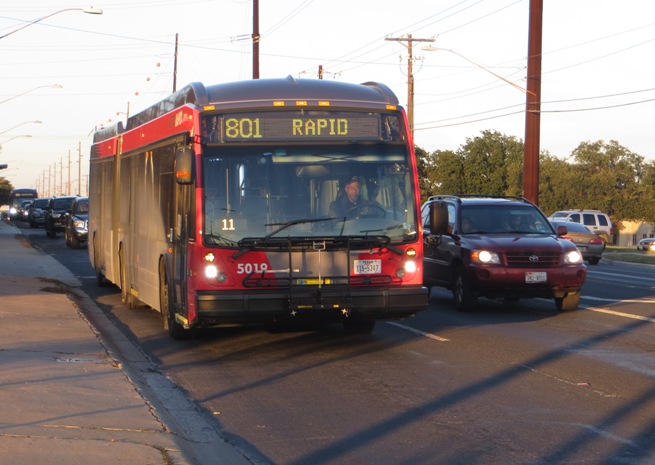
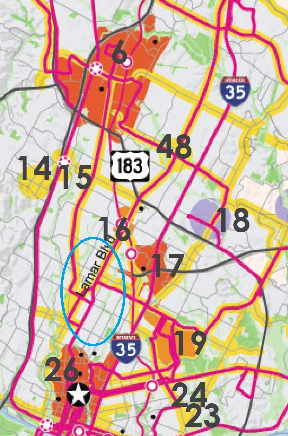
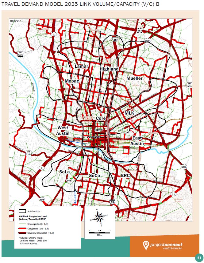
North Lamar traffic (several blocks north of the Triangle). Guadalupe-Lamar travel corridor carries heaviest traffic flow of any local Central Austin arterial, serves residential concentration ranking among highest density in Texas, serves 31% of all Austin jobs — yet corridor was “dismembered” by Project Connect and excluded from “Central Corridor” study! Photo: L. Henry.
♦
By Dave Dobbs
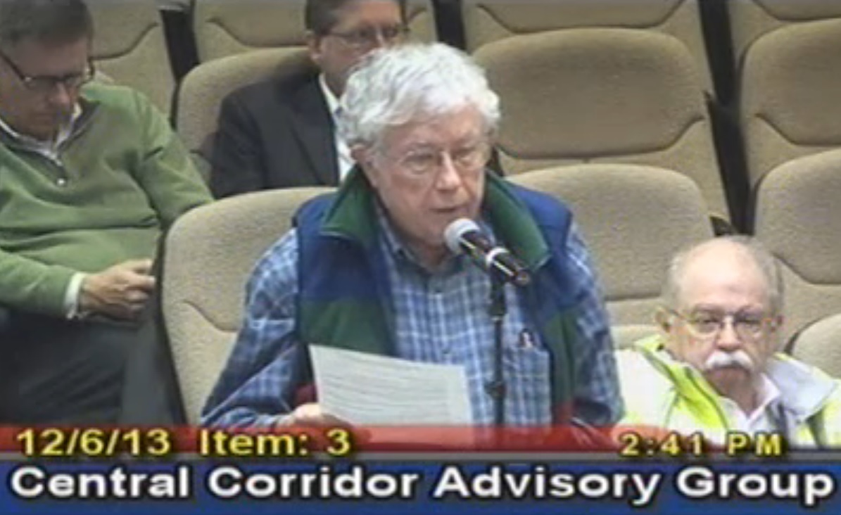
The following post has been slightly adapted and edited from a letter posted by the author to members of the Central Corridor Advisory Group (CCAG) on December 6th. Later that day, CCAG voted 14-1 to endorse Project Connect’s official “ERC-Highland” recommendation.
Dear CCAG members,
Eighteen months ago The Texas Association for Public Transportation (TAPT) offered a comprehensive urban rail plan to the Transit Working Group and to CAMPO that largely fulfilled most of the goals public officials said they wanted from a phase one project. During the last two years of TWG meetings, it became clear that phase one urban rail would need to meet a constrained budget between $275 and $400 million locally that aimed at a 50% federal match for a total project cost of $800 million or less that included Mueller.
The most important elements to reach that goal are summarized on page 42 of the Urban Land Institute’s Daniel Rose Fellowship presentation made at Austin City Hall, Friday February 22, 2011.
Excerpt from ULI presentation.
Rather than take a presumptive speculative sketch-planning approach to what might be 17 years from now, somehow somewhere in the city, TAPT’s plan relied on reality, decades and tens of millions of dollars of past rail planning that culminated in the comprehensive detailed 18-month long Federal Transit Administration (FTA) sanctioned and funded 2000 Preliminary Engineering/Environmental Impact Study (PE/EIS) that forecast 37,400 riders on the Guadalupe-Lamar corridor in the year 2025.
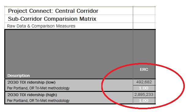
Compare that number to Project Connect’s year 2030 forecast of 2.9 million daily [transit] riders in the East Riverside Corridor (ERC). This is more daily [transit] riders than [in] any US city except New York. Even the low 2030 ERC forecast of 492,682 riders daily is 17% more daily riders than San Francisco’s 104-mile BART heavy rail system, one of the best rail systems in America.
As Mr. Keahey explained at last Wednesday’s [Dec. 4th] Alliance for Public Transportation meeting, a PE/EIS goes way beyond and is far more detailed than the kind of planning his team is currently engaged in, and as a transit [professional], I concur completely.
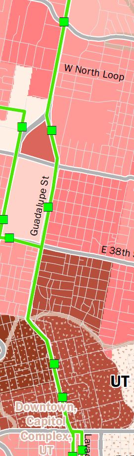
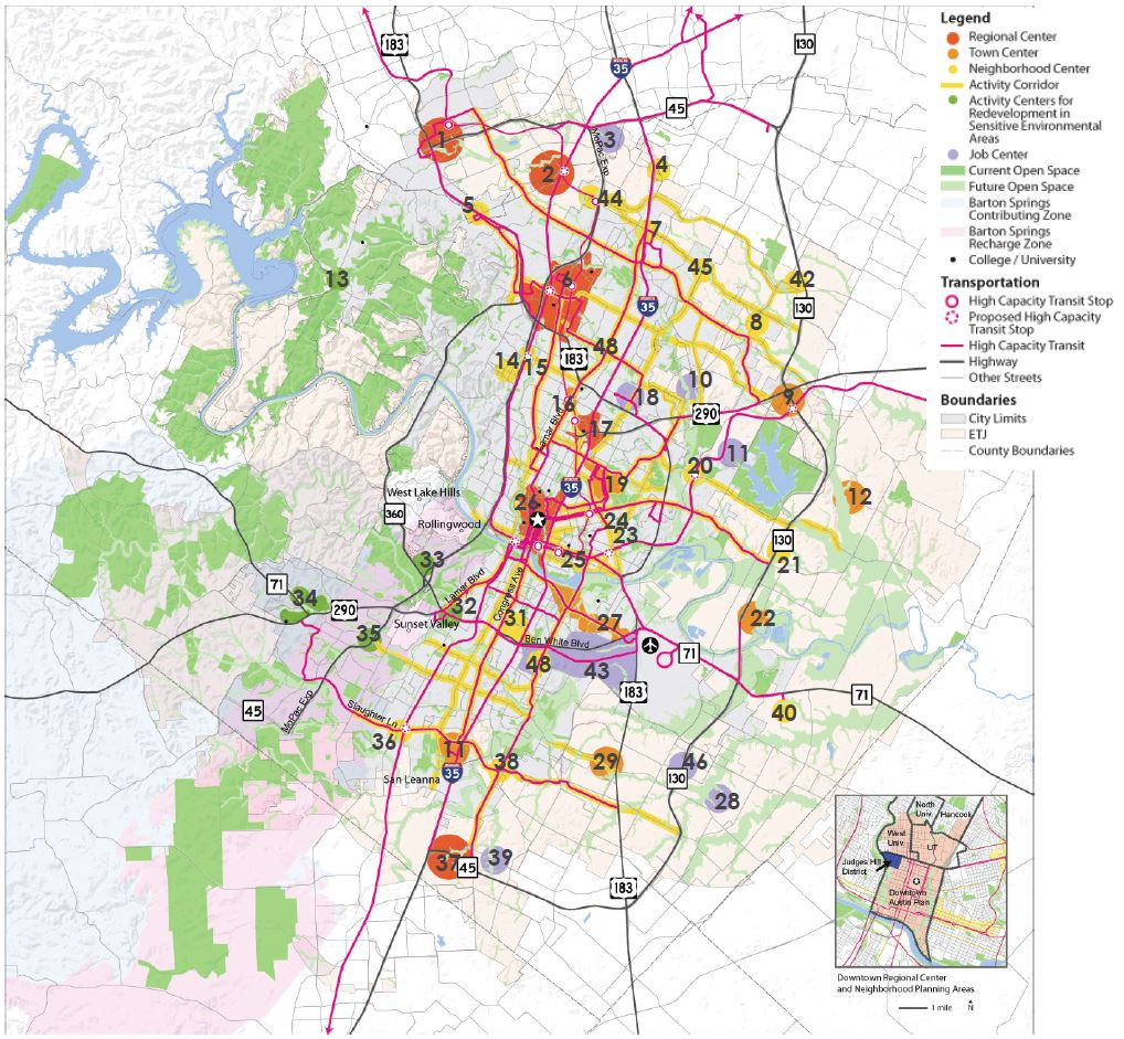
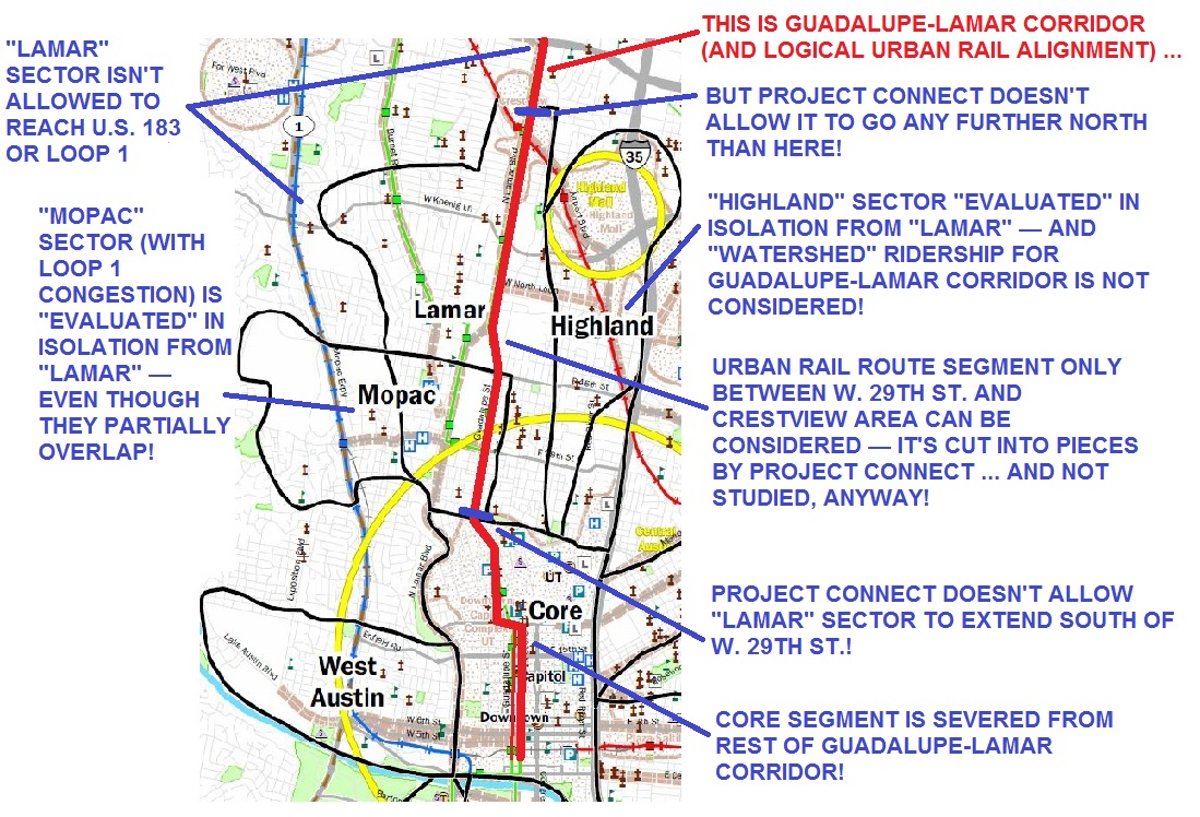
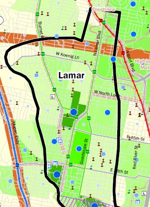
Excerpt from infographic in Project Connect’s Map Book v. 5. Data presented shows Austin’s highest population density clustered around West Campus-Guadalupe-Lamar corridor — but this travel corridor was omitted from Project Connect’s study! Green line on Lamar-Guadalupe represents MetroRapid bus route 801, green squares represent MetroRapid stations. In upper left of map, note that MetroRapid route 803 (primarily serving Burnet Rd. corridor) joins Guadalupe at E. 38th St. and shares route with #801 into core area.
The 2000 PE/EIS recognized that most of Austin’s growth has been North and Northwest and that’s likely to continue well into the future because that is where we’ve made most of the regional infrastructure and transportation investments for decades; e.g., IH-35, Loop 1, US 183, US 183A, SH45, etc. For a host of reasons, future growth will almost surely be more clustered, more village-like with less single-family dwellings on detached lots and it will be located with access to frequent high capacity transit if (and only if) we provide for it.
When I moved here in 1969 the population of Leander was about 300 people, while today it is over 30,000. Cedar Park, same story. In 1970 it had a population of 125; today Cedar Park is 58,000 plus. These twin towns combined are only 17% smaller than Round Rock (107,000) and have been growing many times faster. Bus ridership and MetroRail ridership reflect this reality, and if we want the most “bang for the buck”, we will put our first phase urban rail where the greatest employment is, where the congestion is, and where the people are, and are constrained to use alternatives because, in that corridor, urban rail is a more competitive choice than their automobile. As former Capital Metro board chairman Lee Walker put it when he led the 2000 rail referendum, “We’ve got a meltdown in the core and we’ve got to fix it.”
Though we lost that election by a half percent, the situation hasn’t changed. We still have a highly constricted, congested core fed by three main north/south arteries, only one of which is practical and affordable to meaningfully [expand] within the likely funds we can muster at this point in time. And its name is not “Highland”, it’s North Lamar. (Highland is a neighborhood bounded by North Lamar, US183, IH35 and Denson Drive and it has endorsed rail on Guadalupe/Lamar.) Even “sliced and diced”, Project Connect’s own mapbook data shows that Guadalupe/Lamar is the highest density travel corridor in Austin. Reconnecting America’s Jeff Wood, former Austinite with a UT Master’s degree on Austin’s rail history and leading authority on urban rail impacts says, “Rail line(s) extend existing market gravities, but do not create new ones … development corresponds with proximity to major employment. Ultimately, what matters is proximity to employment as to whether denser transit oriented development will happen. The major employment is along Guadalupe Lamar.” Wood bases his remarks on “Rails to Real Estate Development Patterns along Three New Transit Lines”.
So Guadalupe-Lamar is the bird in our hand, so why strangle it hoping for two birds in the bush 17 years in the future? Why are we squandering our best asset based on fantasy data derived by misusing a growth model from Portland, a city with the strongest land-use laws in the country? Reinforcing what we have with a well-designed cost-effective “most bang for the buck” first phase rail line is the only way to provide the driving synergism necessary to build future support for extensions. As Moody’s recent SH130 credit downgrade so dramatically illustrates, just because you build it doesn’t mean they will come.
And, please, let’s dispense with the fiction that MetroRapid is a substitute for rail, because, in fact. it’s just a nicer bigger bright red replacement for bus 101; no faster unless we tear up the street and install expensive dedicated concrete bus lanes, which is, in fact, the proposed plan, but the Project Connect team doesn’t talk about that unless they are specifically asked. (See “No urban rail on Guadalupe-Lamar? Then get ready for bus lanes…”)
Which brings me back to where I started. Why have those in charge of the process never given TAPT’s urban rail loop plan the same hearing opportunity before decision-makers that, say, Gateway Planning received in the spring of 2012 before the TWG? We, after all, are the oldest urban rail stakeholders in the city, a Texas non-profit corporation, dedicated to promoting public transit and rail transit since 1973, drafting Austin’s first rail proposals in the early seventies, instrumental in the creation of Capital Metro in the 1980’s, playing a major role in formulating CMTA’s original service plan and whose leaders are widely recognized and known in the rail transit industry. Lyndon is a former data analyst and planner with Capital Metro and served 4 years as a board member in the early 1990’s. He was the first person (in 1975) to recognize the value and promote acquisition of the current MetroRail line from Southern Pacific in the mid 1980’s.
Both Lyndon and I have served on the APTA Streetcar Subcommittee for the last seven years and we have spent countless hours researching, riding, evaluating, photographing and writing about and promoting rail transit here and abroad for last 35-40 years. Our transit professional list-serve is a constant daily source of transportation information from around the world and we know from traffic analysis that our website, www.lightrailnow.org, is heavily used by transit professionals and advocates and is highly regarded for the accuracy of its content, approximately ten thousand pages in size.
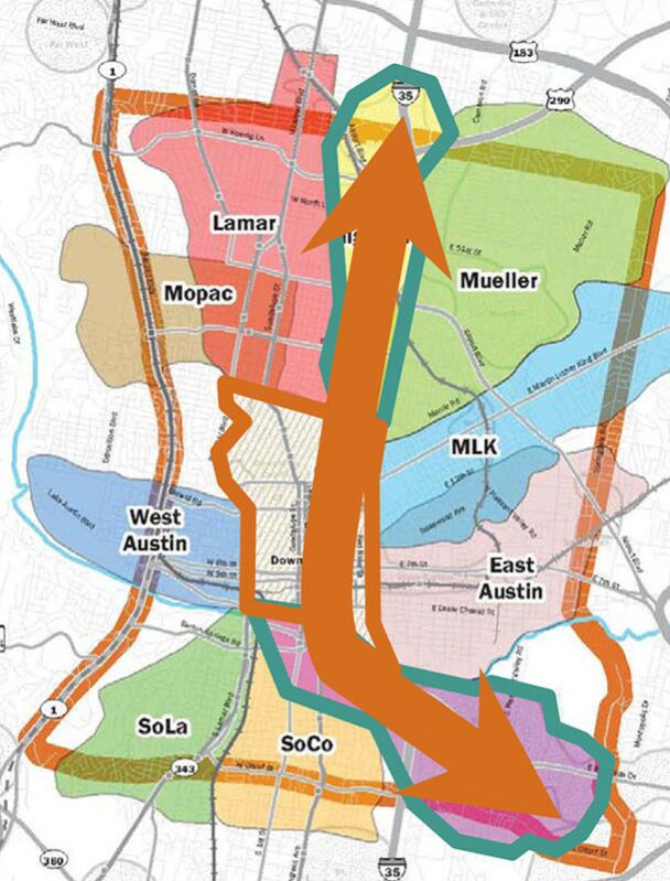
So why has this valuable free local resource been neglected for so long by those in charge of the process? Perhaps the attached image from ROMA’s downtown planning circa 2008 says it all. Note that Austin’s proposed (Project Connect) urban rail plan, despite hundreds of thousands of dollars spent since then, has not changed significantly at all. It’s still Downtown to Mueller past DKR Memorial Stadium and an East Riverside Corridor line. Amazing! But please note the Mueller-only line is now called “Highland.”
Original urban rail “circulator” system in 2008 map of ROMA consulting team plan, contracted by City of Austin.
Attached, is TAPT’s urban rail loop plan in a one-page pdf that you may have seen in a simpler format on our Austin Rail Now blog. Just like the City’s plan above (Project Connect) our plan was peer-reviewed by transit professionals, people who have actually worked here in Austin on light rail projects in the past.
TAPT proposes “loop” line, with routes on both Guadalupe-Lamar and eastside through converting the MetroRail line to electric light rail — plus a spur to Mueller.
…
Thank you for your service to the community.
Sincerely,
Dave Dobbs
Executive Director, TAPT
Publisher, LightRailNow!
Texas Association for Public Transportation