Archive for October, 2013

h1

Houston’s MetroRail shows the way — How to fit urban rail into Austin’s Guadalupe and Lamar

30 October 2013
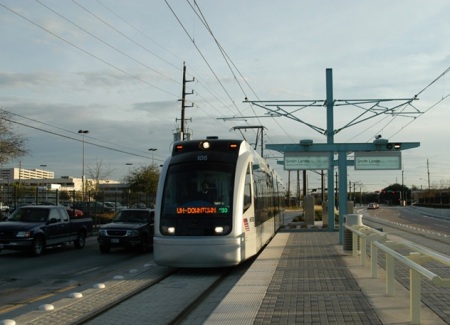
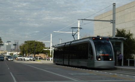
Two-car Houston MetroRail light rail train glides northbound in reservation along Main St. Notice landscaping in median, where station platforms are also placed. Photo: Mike Harrington.

Two-car Houston MetroRail light rail train glides northbound in reservation along Main St. Notice landscaping in median, where station platforms are also placed. Photo: Mike Harrington.

It’s pretty amazing.

While the so-called “People’s Republic of Austin” has agonized, dillied, dallied, and dawdled for years over whether or not to give priority to transit, or to preserve sacred traffic lanes for cars, Houston — long assumed to be a poster child of motor vehicle dependency — already took the plunge over a decade ago, carving dedicated transit reservations out of some of its busiest central-city arterials for its MetroRail light rail transit (LRT) line.

Opened in 2004, Houston’s MetroRail runs 7.5 miles with 16 stations through the heart of the city, from University of Houston–Downtown to Fannin South, using well-separated reservations created by re-allocating former traffic lanes and turning (“chicken”) lanes to rail transit. It’s highly successful, carrying 37,500 rider-trips per average weekday (second quarter 2013) at about 8% lower cost per passenger-mile than Houston’s bus system average (National Transit Database, 2011).

MetroRail is routed almost entirely on major arterials through central-city Houston. Map: Light Rail Now.

MetroRail is routed almost entirely on major arterials through central-city Houston. Map: Light Rail Now.

From the standpoint of the engineering design of its alignment, MetroRail presents a model of what could be possible in Austin’s Guadalupe-Lamar (G-L) corridor. Facing the constrained street right-of-way available, Houston’s local decisionmakers and planners bit the bullet, opting to re-allocate entire street lanes away from motor vehicle traffic, and allot the space to the much higher carrying-capacity of the planned new LRT line.

The most drastic re-allocation occurred on Main St., which in its most constrained section was originally a four-lane street with a center turning lane. About 40% (northern section) of the route runs in Main; there’s a short section of several blocks with the line split between Fannin and San Jacinto Streets; then the remaining southern portion of the route runs in Fannin.

Photo-essay: Houston MetroRail

The remainder of this post is mostly a photo-essay on selected street alignment features of Houston’s MetroRail, particularly showing how previous traffic lanes have been re-allocated to transit in route sections most closely resembling the conditions of Guadalupe St. and Lamar Blvd. in Austin.

Main St. alignment


Overhead view of MetroRail on Main St. at Preston. Photo: Houston Metro.

Overhead view of MetroRail on Main St. at Preston. Photo: Houston Metro.

The MetroRail LRT system was installed in Main Street as part of a massive overhaul of Houston’s downtown streets beginning in the late 1990s. The objective was to emphasize pedestrian and transit access while reducing motor vehicle traffic.

In the photo above, you can see how LRT tracks and stations — and widened sidewalks — have replaced what was once several traffic lanes. Traffic has been reduced to one lane in each direction, with occasional parking space, mainly so adjacent stores and offices can be accessed by commercial services.


Main St. without MetroRail. Photo: Wikipedia.

Main St. without MetroRail. Photo: Wikipedia.

Further south from downtown, near the Medical Center, the MetroRail alignment leaves Main St., and continues in Fannin and San Jacinto Streets. However, Main continues south.

In the photo above, Main St. is a bit wider than it is in the more constrained section downtown, but you can still get an idea of how the street looked before MetroRail.


Main St., 2 views of MetroRail alignment. LEFT: Train near Preston (photo: L. Henry). RIGHT: Train near Gray (photo: Frank Hicks).

Main St., 2 views of MetroRail alignment. LEFT: Train near Preston (photo: L. Henry). RIGHT: Train near Gray (photo: Frank Hicks).

The two photos above illustrate the MetroRail alignment from ground level — the left photo in the heart of downtown, the right photo further south on the edge of downtown. Notice the use of large traffic buttons to emphasize segregation of LRT tracks. Also notice how the median area between tracks is used for both stations and landscaping.


MetroRail passengers deboarding at Downtown Transit Center station. Photo: Peter Ehrlich.

MetroRail passengers deboarding at Downtown Transit Center station. Photo: Peter Ehrlich.

This view, showing passengers deboarding a MetroRail train at the Downtown Transit Center station, provides another ground-level view of a station fitted into the Main St. streetscape.


MetroRail passing under I-45. Photo: Peter Ehrlich.

MetroRail passing under I-45. Photo: Peter Ehrlich.

Houston’s MetroRail passes under a couple of freeways as it heads south from downtown. No reconstruction of the grade separations was necessary — track and overhead contact system (OCS) wires were simply installed through the underpass. Here, a train on Main St. passes under the I-45 freeway not far from the Downtown Transit Center station. This may offer design hints for solving similar underpass LRT needs in Austin, such as the proposed extension of the Guadalupe-Lamar line under the US 183 underpass.


Aerial view of MetroRail on Main St. at Ensemble-HCC station. Photo: Screen capture by L. Henry from Google Maps.

Aerial view of MetroRail on Main St. at Ensemble-HCC station. Photo: Screen capture by L. Henry from Google Maps.

This aerial view of the alignment in Main St. at the Ensemble-HCC station gives another perspective on how MetroRail has been fitted into the streetscape south of central downtown. Stations are staggered, with separate platforms and shelters to serve either northbound or southbound trains (thus not requiring extra street width).


Double-track to single tracks on Fannin-San Jacinto

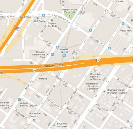
Map showing MetroRail transition from Main St to Fannin-San-Jacinto (Screen capture by L. Henry from Google Maps).

Map showing MetroRail transition from Main St to Fannin-San-Jacinto (Screen capture by L. Henry from Google Maps).

The map above shows where the double-track MetroRail alignment leaves Main St. (at Richmond and Wheeler Ave.), runs diagonally southward, and then splits (just after passing under the Southwest Freeway), with the southbound track following Fannin St. and the northbound track following San Jacinto St.


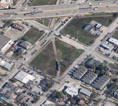
Aerial view of 2 tracks splitting into single tracks on Fannin and San Jacinto. Photo: Screen capture by L. Henry from Google Maps.

Aerial view of 2 tracks splitting into single tracks on Fannin and San Jacinto. Photo: Screen capture by L. Henry from Google Maps.

In the aerial view above, the double-track MetroRail alignment can be seen running diagonally, passing beneath the Southwest Freeway, and then splitting into single tracks on Fannin St. and San Jacinto St., where the tracks are laid in curbside alignments.


MetroRail Museum District station. Photo: Houston Metro.

MetroRail Museum District station. Photo: Houston Metro.

The photo above shows the curbside MetroRail alignment and a curbside platform at the Museum District station. Note how light rail station platform is raised approximately 14 inches above track level (which is also street level) to permit level boarding into each car. The woman will be able to roll her baby carriage directly onto the train, with no lifting or need for a ramp.


Double-track alignment in Fannin and Braeswood

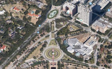
Aerial photo of Fannin-San Jacinto single tracks merging into double-track on Fannin. Photo: Photo: Screen capture by L. Henry from Google Maps.

Aerial photo of Fannin-San Jacinto single tracks merging into double-track on Fannin. Photo: Photo: Screen capture by L. Henry from Google Maps.

This aerial view shows how the single-track alignments on Fannin and San Jacinto are merged south of Hermann Drive into a double-track alignment on Fannin St.


MetroRail Hermann Park-Rice University station on Fannin St. Photo: Peter Ehrlich.

MetroRail Hermann Park-Rice University station on Fannin St. Photo: Peter Ehrlich.

Somewhat further on south on Fannin St. is the Hermann Park-Rice University station. This cross-sectional view shows how the median island-type station, serving both directional tracks, is fitted into the roadway, with trackage separated by traffic buttons.


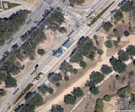
Aerial view of Hermann Park-Rice University station. Screen capture by L. Henry from Google Maps.

Aerial view of Hermann Park-Rice University station. Screen capture by L. Henry from Google Maps.

The photo above provides an aerial perspective of the Hermann Park-Rice University station.


Train serving Memorial Hermann Hospital-Houston Zoo station. Photo: Panoramio.com.

Train serving Memorial Hermann Hospital-Houston Zoo station. Photo: Panoramio.com.

This ground-level photo of a train stopped at the Memorial Hermann Hospital-Houston Zoo station illustrates how (to accommodate the narrower roadway width) station design has reverted to the staggered-platform layout, with separate platforms and shelters for each direction .


Passengers waiting to board train at Dryden/TMC station Photo: Brian Flint.

Passengers waiting to board train at Dryden/TMC station Photo: Brian Flint.

Because of the tight street constraint, the Dryden/TMC station has a staggered-platform profile similar to the Memorial Hermann Hospital-Houston Zoo station.


Aerial view of Dryden/TMC station. Screen capture by L. Henry from Google Maps.

Aerial view of Dryden/TMC station. Screen capture by L. Henry from Google Maps.

This aerial view of the Dryden/TMC station illustrates how left turn lanes are handled. Notice that there are left-turn channelization arrows painted in the trackway. Cars are allowed access into these turning lanes (i.e., sharing the LRT tracks) via the traffic signal system. Notice cars in the upper right photo queued in the lane and preparing to turn left.


MetroRail train on S. Braeswood Blvd. Photo: Peter Ehrlich.

MetroRail train on S. Braeswood Blvd. Photo: Peter Ehrlich.

For a short “dogleg”, the MetroRail alignment departs from the Fannin route and runs in S. Braeswood Blvd. and Greenbriar Drive before returning to Fannin. This photo shows how the trackage is aligned in that section of the route.


Conclusion

Certainly, Houston’s MetroRail doesn’t represent a design “blueprint” for Austin (or any other community) that can simply be replicated — every city has its own challenges and needs in terms of streetscape and transit requirements. However, MetroRail does demonstrate an excellent Best Practices guide as to how this major auto-centric and asphalt-centric city has found the will and the way to incorporate workable, efficient, and attractive urban rail into a fairly constrained streetscape environment.

h1

Project Connect admits major data error in Guadalupe-Lamar corridor study

27 October 2013
Snippet of Project Connect's much larger "Central Corridor" map (actually, the central-city study area) shows "Lamar" sector (in orange, dubbed a "sub-corridor" in Project Connect's peculiar nomenclature) plus several adjacent sectors. Actual Guadalupe-Lamar travel corridor includes both the Lamar and Core sectors, but each sector is being evaluated in isolation.

Snippet of Project Connect’s much larger “Central Corridor” map (actually, the central-city study area) shows “Lamar” sector (in orange, dubbed a “sub-corridor” in Project Connect’s peculiar nomenclature) plus several adjacent sectors. Actual Guadalupe-Lamar travel corridor includes both the Lamar and Core sectors, but each sector is being evaluated in isolation.

The Project Connect urban rail planning team has been conducting a nominal study of designated alternative “sub-corridors” for urban rail (they’re actually not “corridors”, but sectors of the central-city study area). In the process, the agency has been compiling purported data (covering key indicators for each “corridor”, or study sector, such as population, density, transit ridership, etc.) in a series of so-called Map Books (each one an update of the previous one).

Meanwhile, tirelessly and tediously scrutinizing each volume of Map Book data has been the self-appointed task of Scott Morris, head of the Central Austin Community Development Corporation (CACDC), which, together with Texas Association for Public Transportation, has been advancing the case for the Guadalupe-Lamar travel corridor as the most effective alignment for Austin’s proposed urban rail starter line. Scott has performed amazingly detailed and well-supported research into these data issues, and he has found and pointed to a lengthy array of dozens of mostly serious errors. A handful of these have been quietly rectified.

One of the most serious data anomalies that Scott has recently detected is the “disappearance” of virtually all the ridership for Capital Metro’s routes #1M/L and #101, the heaviest-ridership transit routes in the system, serving the G-L corridor as well as South Congress. This was cited in a listing of nearly three dozen data problems submitted by CACDC to the Project Connect urban rail study team:

v4 Comment 29 High
Pages 36-37 Bus Ridership 2011
According to the 2020 service plan in January 2010, the #1 North Lamar and the #101 had over 17,000 daily boardings combined. But, this chart seems to omit nearly all boardings for the Guadalupe-North Lamar Corridor.

At last, Project Connect has publicly admitted at least one of the numerous errors that have been published in the series of Map Books. Responding mainly to criticism by Jace Deloney, one of the leaders of Austinites for Urban Rail Action (AURA, which supports a transparent, open, and fair route evaluation process), on October 22nd Project Connect issued a statement acknowledging the erroneous ridership data, which it says resulted from “populating” the map (data visualization graphic) with the “wrong data field”. A screen capture of the statement is shown below.

Project Connect statement admits major error in transit ridership data for Lamar-Guadalupe corridor.

Project Connect statement admits major error in transit ridership data for Guadalupe-Lamar corridor.

Data errors, in particular large ones like this, are especially serious because the selection of a “corridor” (actually, a sector of the huge central-city study area) depends critically on key data factors, including existing transit ridership in a given corridor.

h1

Guadalupe-Lamar urban rail line would serve 31% of all Austin jobs

24 October 2013

ARNx0_CACDC_map_Austin-Urban-Rail-Employment-Centers-2013-snip

An urban rail line installed in the Guadalupe-Lamar (G-L) corridor (plus a short extension to the Seaholm area) would provide high-quality, high-capacity transit service to nearly one-third of all Austin jobs, according to a study based on 2011 U.S. Census data by the Central Austin Community Development Corporation (CACDC), led by Scott Morris.

ARNx1_CACDC_map_Austin-Urban-Rail-Employment-Centers-2013

The CACDC’s Austin Urban Rail website presents a map of a possible alignment on Guadalupe-Lamar, including 14 stations with locations optimized by the census employment data. The CACDC study says that that the On The Map online census utility “was used to measure jobs located within one quarter mile and one half mile of each proposed station point.”

According to the U.S. Census Bureau, Center for Economic Studies 2011 Current Employment Statistics, the Guadalupe-North Lamar Sub-Corridor contains the highest density of jobs in the city. … The results speak for themselves. If built, the Guadalupe North Lamar alignment would put tracks within a ten minute walk of over 31% of all jobs in the city.

One can infer that, if the G-L corridor route were combined with the proposed conversion of the eastside Red Line to electric urban rail (light rail transit) as proposed by Texas Association for Public Transportation — a proposal which includes a spur line into the Mueller site and Northeast Austin — it’s plausible to speculate that the total system would possibly provide access to as many as 40 to 50% of city jobs. And, in addition, serve the huge ACC campus developing at Highland.

TAPT proposes "loop" line, with routes on both Guadalupe-Lamar and eastide through converting the MetroRail line to electric light rail — plus a spur to Mueller.

TAPT proposes “loop” line, with routes on both Guadalupe-Lamar and eastside through converting the MetroRail line to electric light rail — plus a spur to Mueller.

h1

Why the MetroRapid bus project currently is NOT an obstacle to urban rail in Guadalupe-Lamar

19 October 2013
New MetroRapid buses, representing about 53% of total project cost, could readily be redeployed to other routes or new premium-bus services. In the meantime, MetroRapid service on Guadalupe-Lamar could be re-purposed and presented as precursor to urban rail. (Photo: Filipa Rodrigues, KUT News)

New MetroRapid buses, representing about 53% of total project cost, could readily be redeployed to other routes or new premium-bus services. In the meantime, MetroRapid service on Guadalupe-Lamar could be re-purposed and presented as precursor to urban rail. (Photo: Filipa Rodrigues, KUT News)

by Lyndon Henry

The question of which route to choose for an initial urban rail line — the officially preferred downtown-East Campus-Mueller plan or the Guadalupe-Lamar (G-L) plan — is linked to the related issue of the $47.6 million MetroRapid bus project currently under way in this and other corridors and due to open for service in 2014. However, as this blog has noted, as currently intended, designed, and funded, MetroRapid — 80% funded from a $37.6 million grant under the Small Starts program of the Federal Transit Administration (FTA) — is about as minimalist as a bus upgrade project can get, involving little more than the following:

Rolling stock — A fleet of new buses, intended to run almost entirely in mixed general traffic with private motor vehicles. These could readily be redployed into other transit routes or entirely new corridors.

Upgraded bus stops — Mostly modular in design (i.e., shelters, benches, etc. could be relocated to other locations). These will be equipped with digital cellular-based schedule information systems that are also modular.

Downtown transit priority lanes — A project to install these (i.e., restripe a lane on each of Guadalupe and Lavaca St. and relocate bus stops) is currently under way. However, as we noted in a previous posting (referring to Portland as a model for transit priority lanes),

there are legitimate questions as to whether these two lanes could simultaneously and effectively accommodate the two MetroRapid bus routes (10-minute headways each) plus all other Capital Metro routes (various headways) as well as urban rail (10-minute headway), all running in both directions.

Rebranding and marketing — Rechristening limited-stop buses on G-L (a service configuration basically replicating the #101) as a “rapid” service (although the schedule time difference is minuscule to zero). See: Why MetroRapid bus service is NOT “bus rapid transit”.

MetroRapid bus route (black line) planned for the G-L corridor. Red line denotes MetroRapid in the Burnet-South Lamar corridor. (Map: Capital Metro)

MetroRapid bus route (black line) planned for the G-L corridor. Red line denotes MetroRapid in the Burnet-South Lamar corridor. (Map: Capital Metro)

Besides all the rebranding and marketing hype, one can legitimately ask: What’s really different about MetroRapid?

• Buses, including limited-stop (even with special branding) have been running in the G-L corridor for decades…

• Capital Metro has repeatedly upgraded both rolling stock and bus stop facilities using federal grant funding…

You could say … Well, there are those downtown transit priority lanes. But Capital Metro and City of Austin planners have long intended to use those also for urban rail! As we hinted in the article on Portland cited above, crowding all downtown bus operations plus MetroRapid plus urban rail into those two lanes does seem to present a problem … but that’s an issue we’ll deal with in a subsequent article. (For urban rail, our remedy is to allocate two more separate lanes.)

So, we have this very minimalist FTA-funded Small Starts bus project (MetroRapid), simply running buses in the street with traffic, and yet, to support their case for Mueller and dismiss the case for urban rail on G-L, some local planners and Project Connect officials have been claiming that the FTA will bar funding of an urban rail project because it would disrupt this small-scale project. Despite the fact that:

• The MetroRapid project was never intended to become an immutable obstacle to rail in the G-L corridor…

• The new buses could be redeployed to other uses — including to urban rail stations in the same streets…

• The modular bus stop facilities (including the cellular information system) could be relocated and redeployed, or simply left in place for use by passengers for the other local bus services…

• MetroRapid in the G-L could simply be re-purposed and rebranded as a precursor to urban rail in the same corridor…

MetroRapid bus stations are minimalist, low-cost, modular (movable). LEFT:  Completed station at North Lamar Transit Center (Photo: Downtown Austin Alliance) • RIGHT: Bus stop on Guadalupe at 39th St. being upgraded for MetroRapid (Photo: Mike Dahmus)

MetroRapid bus stations are minimalist, low-cost, modular (movable). LEFT: Completed station at North Lamar Transit Center (Photo: Downtown Austin Alliance) • RIGHT: Bus stop on Guadalupe at 39th St. being upgraded for MetroRapid (Photo: Mike Dahmus)

The heaviest artillery brought to bear for this has not been testimony from any FTA official, nor FTA policies, but a major Washington lobbyist, hired by the City of Austin, and brought to a work session of the Austin City Council in May 2012 to proclaim that the MetroRapid project represents a barrier to rail in the G-L corridor for the next 20 years! (His opinion has subsequently been repeatedly cited as evidence to support the “MetroRapid barrier” contention.)

It’s legitimate to ask: On what basis, and with what actual evidence, are these claims made? Where have other major rail investments been denied because of this supposed justification? Where has FTA explicitly stated that they resolutely forbid altering a portion of an FTA-funded project and substituting a different project for that section prior to the fulfillment of a defined “minimum life cycle”?

The Official (City + Project Connect) position might as well be: We’re already running buses in this corridor, so there’s no role for rail. That, of course, is absurd — existing bus service means you’ve already got well-established transit ridership, a huge plus for rail.

The same holds true of MetroRapid. The argument that this somehow, in its present form, makes it a daunting barrier to urban rail is also nonsense. (They’d like to make it an authentic barrier, by installing special bus lanes … but that’s another issue — see No urban rail on Guadalupe-Lamar? Then get ready for bus lanes….)

Let’s look at several scenarios:

Worst-case scenario — Austin would have to reimburse FTA the $38 million grant in full. Not really likely, but possible. If so, this $38 million would be a relatively small penalty added to the cost of a project of hundreds of millions. Actually, FTA would probably deduct it from the grant for any urban rail FFGA (Full Funding Grant Agreement) that would be submitted in the future.

Acceptable scenario — Austin would be required to reimburse FTA for just the portion from downtown to some point on North Lamar. This seemingly amounts to about 20% or less of the total. It’s also arguable that reimbursement need be based solely on the cost of all or portions the stations and other fixed facilities, but not the rolling stock (which was the preponderance of the grant).

On a route-length basis, the affected G-L portion of the MetroRapid project represents about 20% of the total length. Rolling stock procurement represents about 53% of the total project cost, fixed facilities about 47%. So altogether Austin would be looking at reimbursing 20% X 47% X $37.6 million (FTA grant), which equals … about $3.5 million. And that’s assuming that FTA would not credit the city for re-purposing and re-using these fixed facilities for urban rail or other bus services.

Best-case scenario — No reimbursement needed. Instead, Austin would just re-deploy the buses in other corridors (including further north on Lamar), and be authorized to relocate fixed facilities or re-purpose them (e.g., the traffic-signal-preemption systems would simply be reconfigured for the rail system).

Also note that FTA is accustomed to changes in FFGAs and other contractual elements all the time and doesn’t just blacklist the agency when that happens. Remember — we’d be dealing with just a portion of this total project, and a small portion of just a very small project at that. So we’re not suggesting here a total cancellation of the entire MetroRapid contract.

In dealing with FTA, there are bureaucratic protocols involved, and the need to adhere to stated rules and regulations, but there’s also a lot of politics. The crucial issue for supporters of urban rail in G-L is to influence overall community desire, intent, and policy to re-focus urban rail into the G-L corridor. Once we accomplish that, there’s a very high probability that local civic and political leadership will climb aboard the reoriented urban rail project and work hard to forge the necessary political clout at the federal level.

Also keep in mind that final design and engineering of any rail system will take a fair chunk of a decade. So the MetroRapid system (which should be re-purposed and re-branded as a precursor to rail) will be operating for several years, anyway, before even construction gets under way. Austin could argue that amortization of fixed facilities (and the “BRT” system) should be accounted for in any reimbursement demanded by FTA.

So how is any of the above a real impediment to installing urban rail properly in the right corridor, i.e., the one which should logically continue to be the city’s highest-priority corridor? The contention that the MetroRapid project represents some kind of insurmountable barrier to moving ahead with urban rail in the G-L corridor seems implausible to the point of absurdity.

Portland's light rail transit line on 4-lane Interstate Avenue gives an idea of how urban rail could operate in reservation in G-L corridor. (Photo: Peter Ehrlich)

Portland’s light rail transit line on 4-lane Interstate Avenue gives an idea of how urban rail could operate in reservation in G-L corridor. (Photo: Peter Ehrlich)

This posting has been revised since originally published. It originally reported that “a major Washington lobbyist, hired by the City of Austin” had been “brought to a meeting of the Transit Working Group (TWG) in May 2012….” The lobbyist actually presented his remarks to a work session of the Austin City Council.
h1

Petition — “I want to ride LIGHT RAIL on Guadalupe/North Lamar!”

18 October 2013
TAPT plan (left) and CACDC plan (right) both propose Guadalupe-Lamar as the major focus of Austin's Phase 1 urban rail starter line.

TAPT plan (left) and CACDC plan (right) both propose Guadalupe-Lamar as the major focus of Austin’s Phase 1 urban rail starter line.

Take your pick — the Texas Association for Public Transportation (TAPT) plan, or the Central Austin Community Development Corporation plan — or maybe even another plan for Guadalupe-Lamar (G-L)! — but be sure to sign the CACDC’s petition telling the Austin City Council and involved public transportation agencies you want a light rail transit (LRT) line on the G-L corridor where it belongs!

Wording:

Petitioning The Austin City Council, the boards of Capital Metro, Lone Star Rail, and the Capital Area Metropolitan Planning Organization, and the Federal Transit Administration.

I want to ride LIGHT RAIL on Guadalupe/North Lamar!

Petition by Central Austin Community Development Corporation

Add your (digital) signature here:

https://www.change.org/petitions/i-want-to-ride-light-rail-on-guadalupe-north-lamar#share

h1

Here’s what a real public meeting on rail transit looks like … in San Antonio

18 October 2013
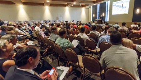
Kyle Keahey, Project Connect's Urban Rail Lead and a consultant to San Antonio's VIA Metropolitan Transit, speaks during a VIA public meeting discussing San Antonio's modern streetcar plans this past July.

Kyle Keahey, Project Connect’s Urban Rail Lead and a consultant to San Antonio’s VIA Metropolitan Transit, speaks during a VIA public meeting discussing San Antonio’s modern streetcar plans this past July.

As this blog has been reporting, despite promises and assurances to local community leaders and activists who’ve been asking for bona fide public meetings to discuss local urban rail planning, Project Connect can’t seem to make one happen. Instead of real meetings, the Austin community has been offered “open houses”, which we’ve compared to “art galleries”, where people can walk through a room of “pretty pictures” (maps, charts, renderings, etc.), supposedly admiring and considering them and submitting comments or questions to the “guards” (planning personnel standing around). See: Back to “art galleries”! Project Connect reneges on community meetings and Meetings, “open houses”, workshops … and democratic process.

But while urban planners here in Austin haven’t been able to pull together a true public meeting, San Antonio has been holding real meetings — such as the one shown in the photo at the top of this post. And Kyle Keahey, Project Connect’s Urban Rail Lead, is also the lead rail planning consultant to San Antonio’s VIA Metropolitan Transit — and there he is, speaking to a San Antonio community meeting on urban rail!

San Antonio streetcar simulation. Graphic: VIA, from Rivard Report.

This was a meeting sponsored by VIA on 30 July 2013 at San Antonio’s Temple Beth-El to discuss the agency’s downtown modern streetcar project. According to a July 31st report in the San Antonio Express-News, “VIA officials gave more details about the possible streetcar routes, including two new ones ….” As the report noted, the two additional route alternatives “resulted from input from many directions — stakeholders along the route, movers-and-shakers and comment sheets from everyday citizens.” The paper also quotes VIA’s chief development officer’s assurance that “The process is to provide public input.”

And, in contrast to Austin, what has San Antonio got going for it — other than a far more realistic timeframe for decisionmaking, and an authentic official commitment to encouraging community participation?

h1

No urban rail on Guadalupe-Lamar? Then get ready for bus lanes…

18 October 2013
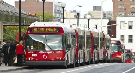
Ottawa's "BRT" Transitway delivers a "conga line" of buses onto urban streets. Photo: Errol McGhion.

Ottawa’s “BRT” Transitway delivers a “conga line” of buses onto urban streets. Photo: Errol McGhion.

by Dave Dobbs and Lyndon Henry

Which kind of transit — urban rail or buses in special lanes — do you want to see on Guadalupe-Lamar?

Not to decide is to decide.

It’s crucial that Austin’s first urban rail (starter) line be a whopping success. This means it must serve the heart of the city in its heaviest-traffic corridor, with its highest densities and employee and employment concentrations, and its most long-established neighborhoods. The Guadalupe-Lamar corridor offers the ideal alignment for an affordable, cost-effective surface light rail alignment.
It’s also important to understand that if we don’t get light rail transit (LRT) on Guadalupe and North Lamar, we most certainly will get dedicated bus lanes within the next 10 years. A major project to overhaul the corridor by installing infrastructure for battalions of MetroRapid buses is waiting in the wings if urban rail is not implemented. This alternative, not requiring a public vote, would produce a far less efficient, adequate, and attractive system, seriously degrade urban conditions, and result in a less livable environment compared with urban rail.

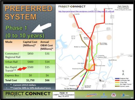
This package of so-called “Bus Rapid Transit” (“BRT”) projects — whereby MetroRapid buses would enter stretches of dedicated bus lanes, and then merge back and forth, into and out of mixed general traffic — was first raised publicly in a Project Connect/City of Austin Transportation Department presentation made in City Council chambers on 25 May 2012 to the CAMPO Transit Working Group (TWG). Shown below is page 10 of that presentation, with arrows pointing to the relevant information.

Excerpt from Project Connect presentation in May 2012 indicating planned $500 million package for MetroRapid "BRT" facilities, including Guadalupe-Lamar. Graphic: Project Connect.
Excerpt from Project Connect presentation in May 2012 indicating planned $500 million package for MetroRapid “BRT” facilities, including Guadalupe-Lamar. Graphic: Project Connect.
These dedicated lanes will be built with 80% federal money, will not require an election, will be vetted publicly only at art gallery-style “open houses”, and approved by boards and commissions, the Capital Metro Board, and the Austin City Council, and then they will be built, unless we implement urban rail in the Guadalupe-North Lamar corridor. And keep in mind that — unlike the current minimalist MetroRapid project — this level of hefty physical investment in roadway infrastructure will become a de facto obstacle to any future rail project in the corridor.

These dedicated bus lanes are the official plan as things currently stand.

There are numerous drawbacks with premium buses, and even “BRT”, compared with LRT. Just to cite a couple:

• LRT on average is significantly more cost-effective than bus operations.

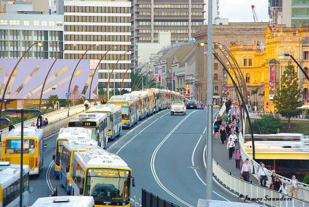
• Buses don’t attract nearly as much ridership as LRT, but as ridership starts to reach higher volumes, bus traffic and overwhelming “conga lines” of buses cause more problems … plus more queues of riders start to slow operations.

Another bus "conga line" leaving downtown Brisbane, Australia to enter busway.

Brisbane, Australia: More “conga lines” of buses travel on reserved lanes between the city’s downtown and a busway. Photo: James Saunders.

If you would prefer urban rail instead of a major bus lane project in Guadalupe-Lamar, it’s essential to speak up and act. Let neighborhood groups and other community organizations know what official plans have in store for this corridor. Sign petitions being circulated to support urban rail on G-L. Communicate to Project Connect and members of Austin City Council that you want to ride urban rail on Guadalupe-Lamar, running in reserved tracks, not just a souped-up bus service weaving in and out of special lanes.

Houston's MetroRail demonstrates that LRT can attract and carry more passengers faster, more effectitly and safely, more cost-effectively than high-capacity bus operations. Photo: Peter Ehrlich.

Houston’s MetroRail demonstrates that LRT can attract and carry more passengers faster, more effectively and safely, and more cost-effectively than high-capacity bus operations. Photo: Peter Ehrlich.

h1

Amsterdam’s Leidsestraat shows how interlaced (gauntlet) track can help squeeze light rail into a narrow alignment

13 October 2013
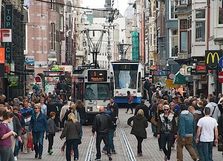
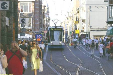
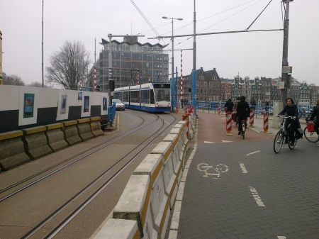
Amsterdam's Leidsestraat shows how gauntlet track allows bidrectional light rail operation in a very narrow alignment, even with very close headways. Also remarkable is how smoothly, efficiently, peacefully, and safely the tram line blends in with, complements, and serves all the pedestrians who walk alongside, behind, and even in front of the trams.

Amsterdam’s Leidsestraat shows how gauntlet track allows bidrectional light rail operation in a very narrow alignment, even with very close headways. Also remarkable is how smoothly, efficiently, peacefully, and safely the tram line blends in with, complements, and serves all the pedestrians who walk alongside, behind, and even in front of the trams. Photo: Roeland Koning .

by Dave Dobbs

In the recent posting How urban rail can be installed in the Guadalupe-Lamar corridor (Oct. 10th), Lyndon Henry discussed how urban rail in the Guadalupe-Lamar (G-L) corridor could deal with right-of-way constraints. For especially confined, narrow stretches, Lyndon suggested that interlaced, or gauntlet, track was an option.

Basically, gauntlet track works like a single-track section, but it doesn’t require movable switchpoints. Instead, it’s completely stationary, with one track in one direction overlapping, or interlacing, with the track in the opposite direction. Then, when the right-of-way becomes wider, the two tracks divide back into separate tracks in each direction again.

To expand on what Lyndon has explained about dealing with constrained rights-of-way (ROW) and the use of interlaced or gauntlet track, probably it’s helpful to focus on perhaps the most famous example — the Leidsestraat, a very narrow street in Amsterdam. This is a city filled with trams (aka streetcars, light rail).

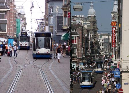
Two views of the Leidsestraat. LEFT: A #1 tram, heading away from camera, has just left the interlaced section onto double track, passing a #5 tram headed toward the camera and the interlaced section. (Photo: Stefan Baguette) RIGHT: You can see the stead stream of trams, sometimes just a couple of minutes apart, passing the heavy flows of pedestrians on each side. (Photo: Mauritsvink)

Two views of the Leidsestraat. LEFT: A #1 tram, heading away from camera, has just left the interlaced section onto double track, passing a #5 tram headed toward the camera and the interlaced section. (Photo: Stefan Baguette) RIGHT: You can see the steady stream of trams, sometimes just a couple of minutes apart, passing the heavy flows of pedestrians on each side. (Photo: Mauritsvink)

In Europe, the tramway is basically surface electric urban rail ­(light rail transit) that can adapt like a chameleon — it is what it is, wherever it is. Flexibility is its trademark and it’s designed to fit within a budget.

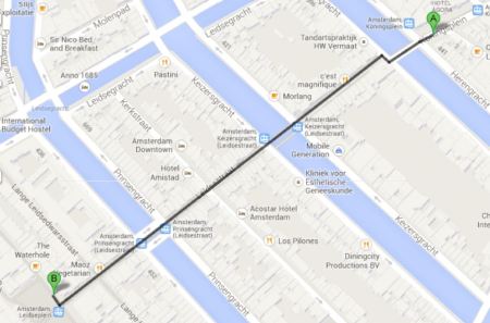
The Leidsestraat is about a third of a mile long in the center of the city and is home to three GVB (transit agency) tram lines running bi-directionally two to three minutes apart (see map below). Trams run constantly back and forth, sharing the gauntlet (interlaced) sections one at a time, and passing one another where the tracks branch out into double-tracked sections, where the street appears to be less than 40 feet (12-13 meters) wide.

Leidsestraat alignment runs about 500 meters (0.31 mile) in length, passing over several canals.

Leidsestraat alignment runs about 500 meters (0.31 mile) in length, passing over several canals. Map: Dave Dobbs (from Google Maps).

Light rail operation in the Leidsestraat is even more remarkable when you consider that it’s one of the busiest autofree streets in the world, teeming with pedestrians and bicyclists (as you can tell from the photos). Motor vehicles are allowed very limited access to serve retail stores, restaurants, and other businesses. Besides how well gauntlet track works with relatively close headways, allowing light rail trains to access this extremely narrow urban street, is how smoothly, efficiently, peacefully, and safely it blends in with, complements, and serves all the pedestrians who walk alongside, behind, and even in front of the trams.

The following are some additional photos of light rail tramway operation along this alignment


Another photo showing crowds of pedestrians, an approaching tram, and a clearview of a transition from double-track to interlaced track. (Photo: Marc Sonnen.)

Another photo showing crowds of pedestrians, an approaching tram, and a clearview of a transition from double-track to interlaced track. (Photo: Marc Sonnen.)


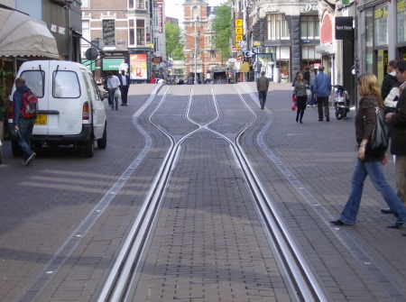
Focus on interlaced track construction in the Leidsestraat. Notice how the two tracks  Notice how the two tracks virtually merge to form what almost seems like a single track — but there are separate parallel rails for each direction, laid next to each other. Also, only one rail in each direction actually cross each other (this type of passive, stationary rail crossing is called a frog).

Focus on interlaced track construction in the Leidsestraat. Notice how the two tracks virtually merge to form what almost seems like a single track — but there are separate parallel rails for each direction, laid next to each other. Also, only one rail in each direction actually crosses the other (this type of passive, stationary rail crossing is called a frog). Photo: Revo Arka Giri Soekatno


Interlaced track is also used in other narrow locations, some shared with motor vehicle traffic. Here a Route 10 tram leaves the interlaced track over the Hoge Sluis bridge, as an autombile waits to proceed over the same right-of-way.

Interlaced track is also used in other narrow locations, some shared with motor vehicle traffic. Here a Route 10 tram leaves the interlaced track over the Hoge Sluis bridge, as an autombile waits to proceed over the same right-of-way. (Photo by TobyJ, via Wikipedia.)


Here’s an excellent 2-minute video showing trams operating in both directions into and out of one of the interlaced sections through the Leidsestraat.

Original YouTube URL:
http://www.youtube.com/watch?v=Gv9Vgo_W0HU

For further information, this link to Wikipedia’s article on Trams in Amsterdam may be helpful:

http://en.wikipedia.org/wiki/Trams_in_Amsterdam

Special thanks to Roeland Koning and his Studio Koning photography service for his kind permission to use his photo of the Leidsestraat at the top of this posting. Visit his website at:

http://www.studiokoning.nl

h1

UT Student Government backs West Campus, Guadalupe-Lamar route for first phase of urban rail

12 October 2013
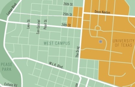
West Campus neighborhood is area in light green just to west (left) of the Drag (Guadalupe, vertical white line just to right of center). UT campus shown in orange. Map: The Galileo, rev. by ARN.

West Campus neighborhood is area in light green just to west (left) of the Drag (Guadalupe, vertical white line just to right of center). UT campus shown in orange. Map: The Galileo, rev. by ARN.

The effort to reset Austin’s urban rail planning focus onto the Guadalupe-Lamar (G-L) corridor got a huge boost on October 1st with the University of Texas Student Government’s passage of a resolution endorsing a West Campus and Guadalupe-Lamar corridor alignment for the Phase 1 starter line of urban rail — thus implicitly rejecting the officially proposed East Campus alignment and route out to the Mueller redevelopment site.

Designated as AR 15, the resolution contains a number of “Whereas” clauses, with meticulous documentation of the facts and arguments underpinning the basic decisions. For example, the resolution notes that

…Future-use plans for neighborhoods that include significant student populations, including the Brentwood/Highland Combined Neighborhood Plan , the North Loop Neighborhood Plan, Central Austin Combined Neighborhood Plan, and Hyde Park Neighborhood Plan support urban rail and stations along the proposed Guadalupe-Lamar alignment; and,

… there has been over $30 million worth of studies that have looked at the feasibility of light rail transit along the Guadalupe-Lamar Corridor since the 1970s; and,

… A 2011 study at the University of California-Berkeley found that “light-rail systems need around 30 people per gross acre around stations and heavy rail systems need 50 percent higher densities than this to place them in the top one-quarter of cost-effective rail investments in the U.S.” and “the ridership gains from such increases…showed, would be substantial, especially when jobs are concentrated within ¼ mile of a station and housing within a half mile”; and,

… the largest concentration of students living off campus, West Campus, is the third-densest population district in the state of Texas with a density of over 25,000 people per square mile; and,

… a large majority of the student population along with a vast majority the Central Austin population lives along the proposed Guadalupe-Lamar alignment, totaling over 54,000 people within a quarter-mile to proposed stations ….

On the basis of this evidentiary background, declares the resolution,

BE IT RESOLVED, That the Student Government of the University of Texas at Austin is in full support of the first phase of light rail running through the Guadalupe-Lamar Sub-Corridor; and,

BE IT FURTHER RESOLVED, That Student Government will support any proposed urban rail line that prioritizes transportation access to where students are currently living….

The full resolution can be accessed as a DOC file:

UT-Stu-Govt_AR 15 – In Support of The Guadalupe-Lamar SubCorridor as Phase I of Austin Urban Rail

Certainly, if this vote by UT’s Student Government is any guide, the majority of UT students want an urban rail route to serve the West Campus, where they can most effectively use it.

h1

Strasbourg’s tram-pedestrian mall: How “transit priority” and “pedestrian-friendly” are blended in Europe

11 October 2013
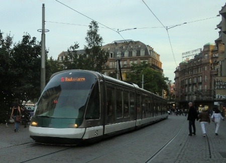
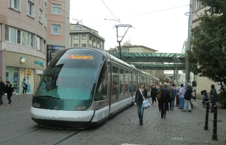
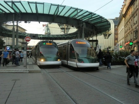
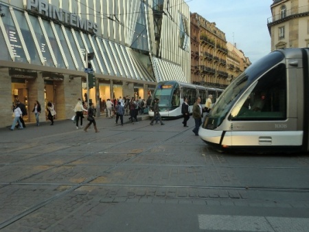
As evening approaches, a tram glides through Strasbourg's Place Kléber as pedestrians stroll along the other track. Photo: Franz Roski.

As evening approaches, a tram glides through Strasbourg’s Place Kléber as pedestrians stroll along the other track. Photo: Franz Roski.

Since urban rail supporters been discussing possible alignment designs for the Guadalupe-Lamar (G-L) corridor, the need for transit-priority lanes, and other issues, it might be helpful and interesting to observe how Europeans address this issue — typically, by converting entire streets to transit-pedestrian malls.

In this case, these recent photos (taken late in the day on 25 Sep. 2013 and posted to the online Eurotrams list by Franz A. Roski) show the transit-pedestrian mall in the French city of Strasbourg.


An A-Line tram approaches Homme de Fer (Iron Man) station as pedestrians stroll alongside the open track. Photo: Franz Roski.

An A-Line tram approaches Homme de Fer (Iron Man) station as pedestrians stroll alongside the open track. Photo: Franz Roski.


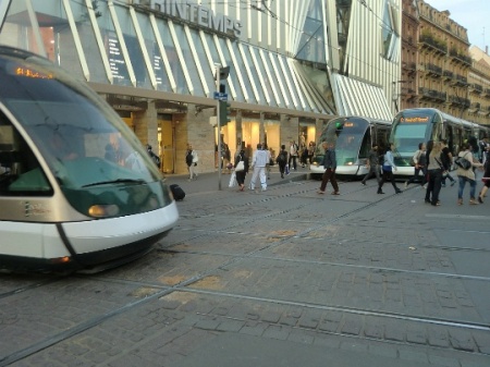
An A-Line tram arrives at Homme de Fer station as a D-Line tram for the opposite direction waits at the in the opposite platform.  Photo: Franz Roski.

An A-Line tram arrives at Homme de Fer station as a D-Line tram for the opposite direction waits at the in the opposite platform. Photo: Franz Roski.


Major crossing of different tram routes near Homme de Fer.  Photo: Franz Roski.

Major crossing of different tram routes near Homme de Fer. Photo: Franz Roski.


Another view of the tram line crossing near Homme de Fer — trams coming, going, and crossing!  Photo: Franz Roski.

Another view of the tram line crossing near Homme de Fer — trams coming, going, and crossing! Photo: Franz Roski.


• Notice the crowds — street capacity for motor vehicles is gone … but look at all the people that have come there, mostly by transit. Where would they park all their cars, anyway?

• Notice the safety issue — pedestrians comfortably, safely walking around, next to, in back of, even in front the light rail trams.

• Notice the tram traffic — trams coming and going, trams crossing the tracks of other tram lines …

Food for thought.

h1

How urban rail can be installed in the Guadalupe-Lamar corridor

10 October 2013
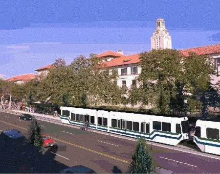
Except for the the somewhat clunkier styling of the railcars, this 2000 simulation of what light rail transit might look like on the Drag is not that different from one of the options today. Graphic: Light Rail Now collection.

Except for the the somewhat clunkier styling of the railcars, this 2000 simulation of what light rail transit might look like on the Drag is not that different from one of the options today. Graphic: Light Rail Now collection.

by Lyndon Henry

Some supporters of the Guadalupe-Lamar (G-L) corridor for Austin’s urban rail starter line have been seeking details about how urban rail (i.e., light rail transit, or LRT) would be installed in these thoroughfares — running in mixed traffic, in reserved lanes, or how? At about the same time, proponents of the Official (aka City of Austin-Capital Metro) proposal for an urban rail line from downtown to Mueller have recently begun raising the issue of right-of-way (ROW) constraints in this same G-L corridor.

It’s important to keep in mind that the Mueller proposal itself has its own ROW constraints and other challenges, but I think it would be helpful here to address some of the issues in the G-L corridor. One of the reasons for this is that I’m not convinced that all parties in the Project Connect team will necessarily make a good-faith effort to find a truly workable, affordable design for inserting urban rail into the G-L thoroughfare alignments — and advocates need to be prepared to insist that valid (and proven) alternatives be examined.

The basic idea is for urban rail (light rail transit, LRT) to operate totally, or almost entirely, in its own lanes. This would require some reconstruction of Lamar Blvd. and probably Guadalupe St. in sections, including slight narrowing of existing lanes, elimination of the turning (“chicken”) lane and replacement with transit-integrated traffic controls (such as left turn lanes), and other measures. Light rail systems in places like Portland, Dallas, Houston, Phoenix, Denver, Salt Lake City, etc. are models for this.

Having crossed intersection, Houston LRT train accesses station on Fannin St. as traffic control system allows queue of motor vehicles to make left turn over track reservation behind it.

Having crossed intersection, Houston LRT train accesses station on Fannin St. as traffic control system allows queue of motor vehicles to make left turn over track reservation behind it. Photo: Peter Ehrlich.

Also keep in mind that Project Connect’s longer-range plan for buses on Lamar-Guadalupe is to install tens of millions of dollars’ worth of reserved lanes — so official planners are already prepared to bite a bullet on this basic issue. What advocates of urban rail in the G-L corridor are saying is that it makes a lot more sense to install reserved lanes for rail rather than buses.

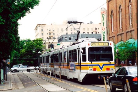
It’s possible that there might be a short section of LRT in mixed traffic (one or both tracks). Sacramento’s LRT operates with this kind of compromise (for about a mile along 12th St., approaching the city’s downtown from the northwest), and has done so for the past 26 years — see Advantages of Light Rail in Street Alignments.
https://austinrailnow.wordpress.com/2013/04/22/advantages-of-light-rail-in-street-alignments/

Sacramento's LRT shares one lane with traffic along 12th St.

Sacramento’s LRT shares one lane with traffic along 12th St.

There’s a very narrow section on the Drag (especially in the 24th-29th St. area) that might require, totally or partially, something like an interlaced (“gauntlet”) track (i.e., two tracks overlapping each other). This would operate effectively like a single-track section but could be fitted into 5-minute headways and possible shorter. (In Amsterdam, interlaced track is even used with 2-minute headways. More on this rail design configuration in a subsequent posting.)

Further downtown, south of MLK Blvd., it would be logical for the double-track line on Guadalupe to split into two single-track lines — southbound on Guadalupe, northbound on Lavaca St. However, it’s likely that LRT would need its own priority lanes in these streets.

Here’s why: The “Transit Priority Lanes” now being installed on the Lavaca and Guadalupe street pair already seem to present major problems for MetroRapid bus, much less LRT. The reason: Official plans involve inserting MetroRapid into a single lane each way along with well over two dozen bus routes. The City’s own 2011 study of this warned that delays to transit might result. And that’s even before urban rail comes along.

It seems eminently reasonable that LRT would need its own reserved lanes on the opposite side of each street (Lavaca and Guadalupe) from the bus lanes. It’s possible that urban rail could perhaps share lane use with MetroRapid, but not with all those other routes.

Since MetroRapid buses can operate only on the righthand side of the street, these buses (with righthand-side doors) couldn’t share a “lefthand” lane with urban rail on the opposite side of each street. So the solution seems to come down to reserving an additional lane exclusively for urban rail on each street.

h1

Portland — Light rail in East Burnside Street

9 October 2013
Light rail train in East Burnside St. approaches intersection and station at NE 181st. Ave. Photo: Adam Benjamin.

Light rail train in East Burnside St. approaches intersection and station at NE 181st. Ave. Photo: Adam Benjamin.

How might an urban rail line — in the form of light rail transit (LRT) — be fitted into four-lane roadways like North Lamar Blvd. and Guadalupe St.?

First, inserting any kind of transit-priority lanes (with or without tracks) requires tradeoffs, including an acceptance of the principle that public transport provides more mobility potential — and people-moving capacity — in the longer term, and needs to be emphasized.

Basically, Austin needs to start making realistic, sensible choices to expedite public transit over general motor vehicle traffic. Officials need to start replacing abstract platitudes about the “importance of alternative mobility” with action. This will require, one way or another, shifting more and more priority to transit.

Second, it’s crucial to keep in mind that there’s a fairly wide variety of options for addressing routing and design issues. Even fairly good consultants aren’t necessarily aware of all of them. There’s no “one and final answer” — community activists need to examine the assumptions and the design alternatives, and have an opportunity to input new ones and have them seriously considered.

Portland, Oregon’s MAX LRT system — operated by the TriMet regional transit agency and generally considered one of the finest models for surface urban rail in the USA — offers a useful example of how LRT can be workably and efficiently inserted into a four-lane roadway. Since 1986, MAX’s Blue Line (the original line that is routed east from downtown Portland to the suburb of Gresham) has run in the middle of East Burnside St. for most of its outer section to Gresham. The following photo-overview gives an idea of design details.


LRT train in E. Burnside St. crossing major arterial

Photo: Peter Ehrlich

Photo: Peter Ehrlich

The photo above shows a one-car MAX LRT train in East Burnside St. after it has just crossed a major intersection with SE Stark. TriMet did not feel it necessary to build expensive grade separations at such intersections.

Also notice that the LRT line in this case is installed with ballasted, not paved, track. This is cheaper (in both capital cost and ongoing maintenance) than paving embedded track, and also discourages incursions by both motor vehicles and pedestrians, thus enhancing safety.


Aerial view of East Burnside LRT alignment

Photo: Google Maps screen capture by L. Henry

Photo: Google Maps screen capture by L. Henry

The aerial view above shows a segment of East Burnside running east-west (from left to right in middle of photo), with the MAX LRT as a brown strip (because of the ballasted track). Here the Burnside LRT alignment crosses NE 181st Ave., a major arterial running north and south and the location of a major station-stop.

Notice how the LRT alignment is relatively narrow (far left and right in photo) but widens somewhat nearing the intersection and each station facility — to allow space for extra turning lanes and the station platforms. Also note how the stations are staggered on each side of the intersection so as to absorb the minimum of right-of-way width. Traffic engineers offset both tracks and traffic lanes slightly, and may add additional right-of-way, to maintain road capacity and even install the narrow turning lanes.

Also, it’s worth noting that, even on this major busy arterial, TriMet saw no need for a grade separation.


LRT alignment showing track and lane offset

Photo: Peter Ehrlich

Photo: Peter Ehrlich

In the photo above, with a train approaching an intersection, you can see that the LRT track has gradually been offset to the right (from the alignment further back in the distance), and the road has been slightly widened, with a turning lane inserted.


Train passing station

In the photo above a train on the opposite track passes the East 102nd Ave. station. Even with a platform width of only 10-12 feet, LRT stations have sufficient space for TVMs (ticket vending machines), a shelter, waiting bench, and other amenities.

Photo: Adam Benjamin

In the photo above a train on the opposite track passes the East 102nd Ave. station. Even with a platform width of only 10-12 feet, LRT stations have sufficient space for TVMs (ticket vending machines), a shelter, waiting bench, and other amenities.


Aerial view showing LRT line, intersection, stations

Photo: Google Maps screen capture by L. Henry

Photo: Google Maps screen capture by L. Henry

In this closer view of the intersection and stations at NE 188 Ave. you can see each of the two station platforms, offset on each side of the intersection. The beige color of each platform contrasts with the brown of the track alignment, and the green-tinted roof of each platform’s waiting shelter can be seen.

Also note the configuration of left-turning lanes. Motor vehicles queue up in these lanes, waiting their special signal to make a turn across the tracks. LRT train operation interfaces with the traffic signal system, and trains have their own special signals.


Train entering intersection, approaching station

Photo: L. Henry

Photo: L. Henry

Here a train passes a station on the other track as it enters the 181st Ave. intersection, approaching the waiting platform for its direction on the other side. On the opposite side of the street, next to the tracks, you can see a car is waiting to make a left turn.

h1

Meetings, “open houses”, workshops … and democratic process

1 October 2013

ARN0_PrjCon_mbrs-logo-xx

In ARN’s previous blog entry, Back to “art galleries”! Project Connect reneges on community meetings, we noted that “In a sudden reversal — and what appears to be a breach of trust and a breach of a de facto agreement with many in the Austin community”, Project Connect (the current ongoing rail planning consortium) had abruptly changed its forthcoming Urban Rail Central Corridor public involvement events from meetings into so-called “Open Houses”.

Our commentary went on to point out that

Meetings are fundamental to truly democratic process. They allow for community interactive input, i.e. community discussion along with the project personnel. They bring members of the entire community together, allow them to hear ideas and views from one another, allow them to interact on the public record (or at least with public witnesses) with officials present, force official representatives to deal with and respond to difficult questions and issues, and allow officials and participants to get a sense of community attitudes expressed in a community manner. One person’s question or comment may give ideas or motivation to other participants.

It should be noted that Project Connect is also deploying other means of communication with the public, in addition to “open house” events — a webinar was held this past Friday, and project staff are also considering workshop-style small-group activities. Plus the team are outreaching through individual meetings with various community groups.

However, while these are worthy activities, they still don’t substitute for the fully democratic process inherent in full, multi-group, diverse community meetings. To repeat our previous observations: Community meetings enable community interactive input; they “bring members of the entire community together, allow them to hear ideas and views from one another, allow them to interact on the public record (or at least with public witnesses) with officials present, force official representatives to deal with and respond to difficult questions and issues, and allow officials and participants to get a sense of community attitudes expressed in a community manner.”

Project Connect, the City of Austin, Capital Metro, and other public agencies have a crucial responsibility to facilitate these kinds of cross-community, cross-demographic, cross-organizational, fully diverse, fully democratic public meetings. So far, they seem to be trying to avoid them like the flu.

Austin Rail Now will continue to support efforts to reinstate the truly democratic public meeting process as Project Connect moves forward with its planning activities.