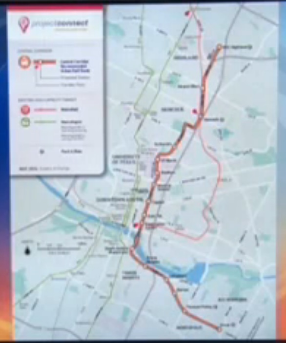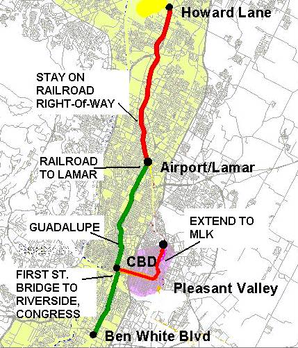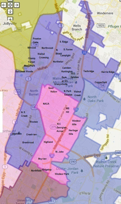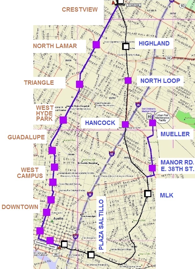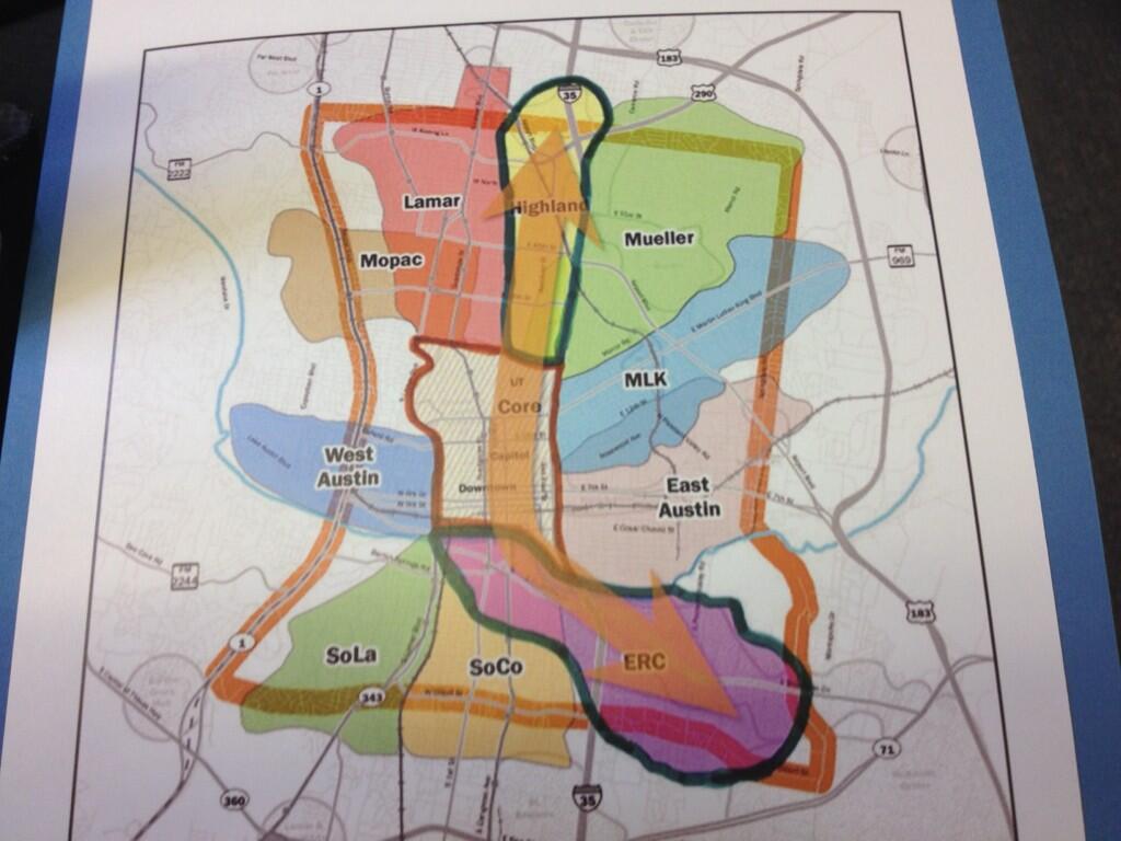
Project Connect’s proposed “high-capacity transit” alternative alignments for “Highland” sector.
♦
By Lyndon Henry
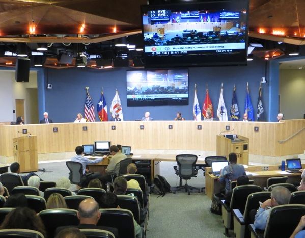
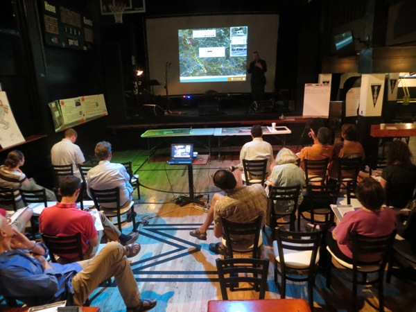
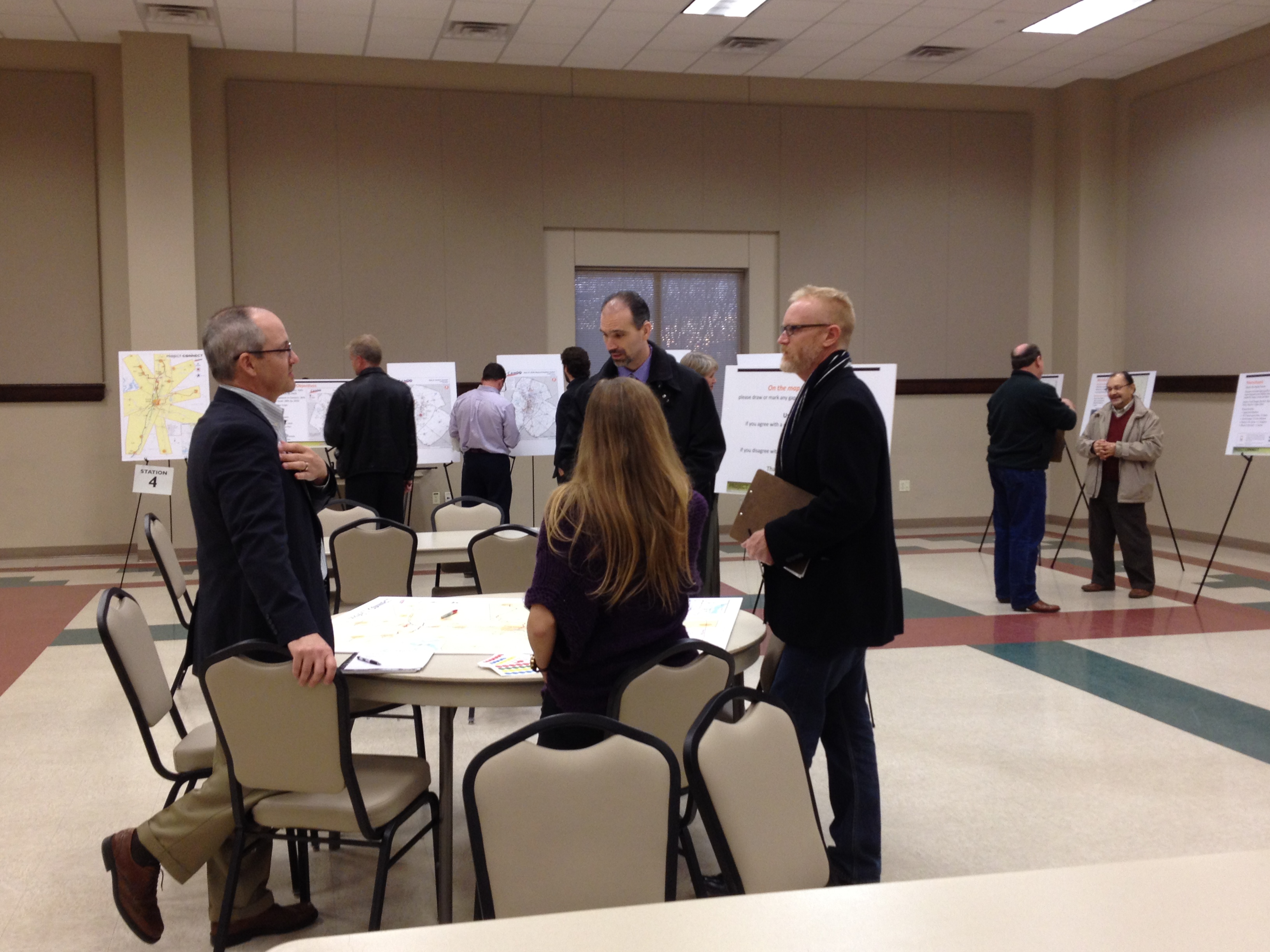
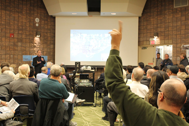
This past Saturday, Feb, 8th, I attended Project Connect’s “interactive workshop” event at the Highland ACC site with a specific mission in mind: raising questions to gather information and data. I particularly wanted to refrain from actually providing input into the process, because Project Connect seems to use this type of public feedback as evidence of popular validation of, and acquiescence to, their overall process, methods, and conclusions — and I wanted to avoid that as much as possible. I did strongly encourage other supporters of the Guadalupe-Lamar alignment proposed for urban rail to attend this event if at all possible.
The most recent documents on the topic of the event, as far as I knew, were the “alternative route” maps that Project Connect had made available online, as a PDF:
http://www.projectconnect.com/connect/sites/default/files/Preliminary%20Alternatives.pdf
Through Project Connect’s presentations to the Transit Working Group and Central Corridor Advisory Group, and in other presentations and statements here and there, a multitude of questions had already been raised, and these maps raised even more issues. Much of my curiosity was motivated by unanswered questions associated with the “Phase 1” study process — supposedly a thoroughly “data-driven” study. Indeed, City Councilman (and Capital Metro chairman) Mike Martinez has emphasized that the route profiles selected by the Project Connect team are all based on a highly “scientific” process. So, in my view, it’s entirely valid to seek the “scientific” evidence that supposedly underpins the route alignment choices now being presented for public perusal.
At the Feb. 8th event, I didn’t have an opportunity to raise all my questions or obtain definitive answers to the ones I did raise, but I’m sharing much of what I did learn in this post. I’ll note that I mainly discussed these with a couple of volunteer Project Connect table moderators, and a couple of Project Connect consultants. I’ve categorized these questions into several sub-issues.
“Highland” issues
• The “Phase 1” study projected huge increases in population and economic activity in this sector by 2030. Where, exactly, would these increases occur?
Basically, the Project Connect representatives I discussed this with didn’t have an answer. They’re planning “high-capacity transit” routes on the basis of projections of enormous population and economic growth, but they seemed somewhat confused about whether there was any data indicating exactly where in this sector such growth would occur.
So, how could station locations be determined if you don’t know where the heaviest growth will be? Is there huge growth projected west of Red River, along the proposed Duval alignment? They couldn’t say.
• Do the proposed alignment alternatives take the actual locations of population and economic concentration into account? If so, how?
Basically, no — for the same reason as with the previous response.
However, I did overhear one of the consultants explain to another participant (who favored an alignment to the Mueller development area) that Project Connect was giving “major consideration” to the possibility that an alignment serving Hancock Center would “set you up” for an ultimate extension to Mueller.
• Of the routes within the “Highland” sector from the UT campus to Highland/ACC, I-35 is omitted. Yet heavy traffic on I-35 was included as a major factor in swaying the Phase 1 recommendation for this sector. So, why is this major travel artery not included as a possible “high-capacity transit” (HCT) alignment for this sector? Where’s the metrics-based evaluation to eliminate it?
The impression I got from discussing this is that there’s no “metrics-based” evaluation, just a sort of hunch that an alignment in or along I-35 would not be a good idea. So, if traffic volumes on I-35 were a major factor in selecting the “Highland” route, are there any park & ride sites in mind? I was told that the Highland/ACC site would be an excellent location for a P&R facility — and that seems a quite reasonable judgement.
However, there’s been no study of the relative attractiveness of such a P&R to I-35 motorists between access to the UT and core area via the eastern “Highland” routes or the more direct, western route via Lamar and Guadalupe.
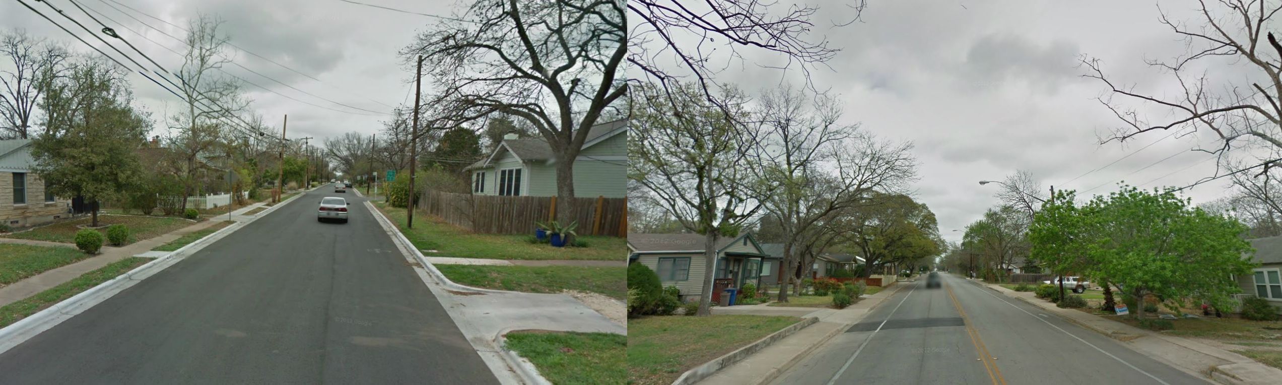
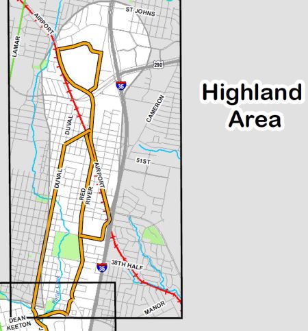
• Duval and Red River are both capacity-constricted minor thoroughfares narrowing into 2-lane neighborhood streets. Are these routes appropriate for the mainline of a HCT service, particularly an urban rail alignment?
Project Connect is seriously considering rail on these streets, but other than that confirmation, I couldn’t get any evaluatory comments. One participant mentioned a possible streetcar-type alignment, and another argued that these were “three-lane” streets, which is hard to believe from the visual evidence. (To procure a third lane, you’d have to eliminate neighborhood street parking on Red River and bike lanes on Duval.)

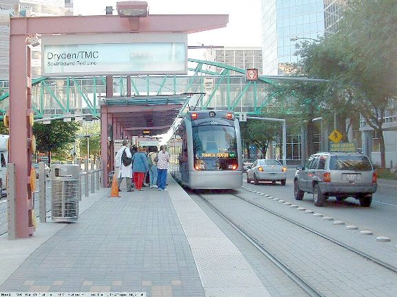
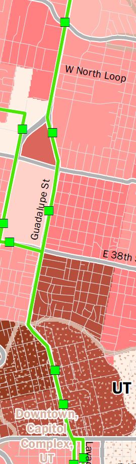
Both Red River (left) and Duval (right) are narrow 2-lane neighborhood streets, with barely space for local parking on Red River and bike lanes on Duval. L. Henry screenshot from Google Maps streetview.
I mentioned that “HCT” by Project Connect’s definition could mean MetroRapid bus service, but I was assured that, for reasons not explained, they have rail in mind for this route.
• To install HCT in these alignments, are property acquisitions for right-of-way (ROW) being considered?
I couldn’t get a clear answer on this.
• For these alignments, are elevated or subway alignments under consideration for urban rail? In the case of a subway, where would the portal be located (this generally takes most of a city block)?
Elevated and subway construction seems to be under consideration only in a very general way; I got the definite impression that Project Connect’s thinking is focused more on a surface alignment. I didn’t have a chance to raise the portal issue.
• Where would a storage-maintenance-operations site for rolling stock be located?
I didn’t have a chance to raise this issue. (Previous urban rail planning tended to locate an SMO facility on the Mueller site, or just north of it.)
• For the alignments along Airport Blvd., wouldn’t these duplicate MetroRail service?
A consultant explained that Project Connect doesn’t see duplication, because the HCT service (whatever it is) would have intermediate stops, unlike MetroRail. Apparently, in their minds, you only have duplication if you duplicate all or most of the parallel line’s stations. I found it rather peculiar that Project Connect planners would regard it as impermissible to replace MetroRapid bus service on Guadalupe-Lamar with urban rail, but quite acceptable to in effect duplicate rail transit service along Airport Blvd. with, possibly, another form of rail transit.
• Is Project Connect planning to replace a segment of MetroRail service with urban rail? If so, how would MetroRail connect from downtown to Crestview?
Apparently they’re not planning to replace MetroRail with urban rail in this phase of planning.
• If Project Connect is planning on FTA funding for urban rail, would this be possible with a line paralleling existing MetroRail service?
As discussed above, Project Connect doesn’t consider such a route along Airport Blvd. as duplicate service to MetroRail. I doubt, however, that — in the case of a major rail investment — the Federal Transit Administration (FTA) would readily agree with this, especially after their recent award of a TIGER grant to upgrade the MetroRail line.
Core area issues
• Various routes are proposed through the core area. On what specific core area metrics analyses are these based?
Project Connect representatives were somewhat confused by this question about core area metrics. Having followed the “Phase 1” HCT study process closely, I never saw evidence of any metrics-focused study of the core area (Core “sub-corridor”, i.e., sector). One consultant offered the University of Texas’s campus plan as a factor in the decision to follow the East Campus alignment along San Jacinto, but I explained that a plan is more like a wishlist, not a metrics-based analysis. I was told that maybe there was some kind of comparison of ridership, cost, etc. between the eastside and westside (Drag/West Campus) alignments, but nobody could produce one.
• Was a data-driven analysis of various alignments, evaluating ridership potential, cost, etc., ever performed for alternative routes through the core area?
Apparently there has been no metrics-based analysis that would guide alignments within the core area. Project Connect basically is taking major activity centers, such as the planned medical school, into account — but this is more based on whim rather than a “scientific” analysis evaluating data-based metrics.
• Was any kind of data-driven analysis of projected demographics, economic activity, etc., ever performed on the core area in the “Phase 1” study?
No, per the answer to the previous question.
• On what “scientific” data metrics-based rationale is the Drag excluded as an alignment through the core area?
Apparently none.
• On what data-driven basis is the crosstown alignment on 4th and 3rd Streets included?
I didn’t have a chance to raise this issue.
“East Riverside” issues
• The “Phase 1” study projected huge increases in population and economic activity in this sector by 2030. Where, exactly, would these increases occur?
As with the responses to similar questions in regard to “Highland” there seems to be no data for this.
• Do the proposed alignment alternatives take the actual locations of population and economic concentration into account? If so, how?
Again, apparently not, as with the previous responses. It would seem that much of the placement of alternatives is based on hunch and whim rather than a “scientific” evaluation of data elements.
• Why have other major potential alignments through this sector, such as Oltorf St., Congress Ave., and S. Lakeshore Blvd., been excluded? All of these were included in the original “ERC” sector in the “Phase 1” study. Is there data-based evidence for singling out East Riverside as the sole alignment?
Again, no one could explain this.
• Project Connect has repeatedly referred to MetroRapid, with buses running in normal general road traffic, as “high-capacity transit”. Why, then, are bridge options being considered for the “East Riverside” area? Could these buses not use existing traffic bridges?
Bridges are being considered for urban rail or possibly special bus-only use. But representatives agreed that, if MetroRapid is HCT, you could have Project Connect’s definition of “rapid transit” fulfilled by running MetroRapid buses in mixed traffic over existing bridges.