
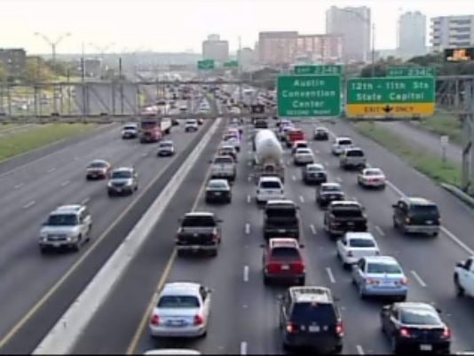
I-35 is the most congested roadway in Texas. But is this really the main travel corridor for commuters from “Highland-Riverside” neighborhoods to the Core Area? And would Project Connect’s proposed urban rail line have any perceptible impact? Photo source: KVUE-TV.
♦
By Dave Dobbs and Lyndon Henry
Lately, Project Connect representatives have been trying to claim that their meandering urban rail route proposed from Highland, through Red River and San Jacinto, to East Riverside, somehow addresses the problem of congestion on … I-35.
Really?
Leaving I-35 at the Highland site to ride a slow train to downtown doesn’t make any sense when, at Highland ACC, you are almost at the Core Area. By the time you leave the freeway, park your car, walk to the station, wait for the train, and ride downtown, you might as well have stayed on the freeway.
The I-35 traffic jam actually begins way north of Highland — at the confluence of Howard Lane, North Lamar, and I-35 — and that’s where people would park and ride a train if it were there. But first we have to build urban rail in the right place — up Guadalupe and North Lamar.
You have to put your transit station, with park & ride (P&R) access, near the outer end of the traffic jam. You don’t have to be a transportation savant to figure this out.
After all, as the public transit planning profession knows very well, P&R facilities need to be provided well upstream of the heavy congestion on a highway facility. There’s very little hope of attracting travelers off the highway if they already have to travel through severe congestion to access the transit station.
Project Connect’s claim of “congestion relief” is especially implausible when you further consider that they’re expecting prospective urban rail passengers to slog their way through the I-35 congestion, then, just a few minutes from their destination, to exit the freeway, hassle with parking, wait for a train, and then take a long, slow, sinuous train ride into the Core Area — a route that includes entering Airport Blvd., navigating through mixed traffic on Red River St., then winding through San Jacinto Blvd. and other streets comprising this tortuous “Highland” route.
What about the the hints from Project Connect that I-35 may be a major artery that neighborhood commuters themselves, along the proposed “Highland” rail route, supposedly use to reach the Core Area? To believe this speculation, you’d have to accept a vision of about 260 commuters per peak hour from these neighborhoods, currently driving, on average, about 6 blocks to then pack themselves onto a severely congested I-35 (#1 on TxDOT’s list of the state’s most congested roads) to then travel an average 28 blocks into the Core. And doing this when they have at least four other important but much less congested local arterials, including Guadalupe-Lamar, to use instead.

Commuters on I-35 would need to drive through miles of heavy congestion to reach Project Connect’s proposed urban rail P&R at Highland ACC — thus, little potential for “congestion relief”. In contrast, Capital Metro’s Tech Ridge P&R is located upstream of I-35 congestion. Alternative Guadalupe-Lamar urban rail plan would have North Lamar Transit Center P&R at US 183, upstream of congestion. Future urban rail extension up North Lamar to Howard Lane could provide another P&R upstream of I-35 congestion. Infographic map by ARN based on Google Maps. (Click to enlarge.)
Maybe, but this is a scenario that similarly invites powerful skepticism. And is it worth over a billion dollars for an urban rail alignment that would lure perhaps about 65 motorists off I-35 in a peak hour (assuming about 25% modal split for Project Connect’s urban rail)?
Instead, as an authentic urban rail alternative to either I-35 or MoPac into the Core Area, you have to travel through the actual heart of the central city and its core neighborhoods on an actual travel corridor where you actually travel to and get off close to your destination. And a lot more of those destinations are within walking distance of Guadalupe-Lamar. That’s why there are 23,000 bus riders daily in this corridor today.
Some transit planner a quarter century ago put it something like this at an Austin public meeting: “All transit studies show that people will climb high mountains and/or swim deep rivers to access good rail service if it’s far enough out and is easily accessible by another mode (i.e., beyond the traffic jam), providing that their final destinations are within a quarter mile of a stop.”
The MetroRail Red Line demonstrates this wisdom; after Howard Lane, for passengers riding inbound AM peak trains, it’s standing-room only. And don’t expect a seat outbound in the evening rush until Howard Lane.
However, the Red Line’s biggest fault is that while it’s quite long enough, it fails to “connect the dots”. It misses serving the heavy-traffic Guadalupe-Lamar corridor, and bypasses core central-city neighborhoods, the UT campus, the Capitol Complex, and most of downtown (while providing virtually useless service for East Austin en route).

MetroRail Red Line (red) skirts entire heart of central Austin, illustrated by “Missing Link” through Guadalupe-Lamar corridor. Urban rail would provide the crucial connections to core neighborhoods, UT West Campus, and Capitol Complex missed by MetroRail. Infographic Map by Light Rail Now.
In bypassing the heart of the city and the Core Area, the Red Line does indeed miss the big dots, but people hate US 183. Before the freeway to Lakeway and beyond, the bumper sticker read: “Pray for me, I drive 183!” Nothing has changed except that we have a much bigger road, even more traffic, more stress. longer drive times, and only a glimmer of a solution around it.
And by far the biggest part of any solution is urban rail on Guadalupe-Lamar.
Summing up: Most I-35 travelers are not going to get off the freeway at the proposed Highland station when the real traffic jam starts to form at Howard Lane. The current bus park & ride, Tech Ridge Transfer Center, for AM commuters to the Core, is located where it makes most sense — much further north (upstream) from Highland, at Howard near I-35.
Again, it comes back to the real alternative: Urban rail on Guadalupe-Lamar, which could serve a P&R station at the North Lamar Transit Center (upstream of the congestion on North Lamar) — with a clear path for further extension north — and interface with train service to the northwest (initially MetroRail, eventually an extension of electric urban rail) serving outlying P&R facilities such as Howard and Lakeline.
We think that’s a “congestion relief” plan that actually makes sense. ■

