
Minneapolis light rail — possible model for Austin » 14_ARN_min-lrt-map-Hiawatha-Ave-E38-St-xng-ohdview_Google-maps
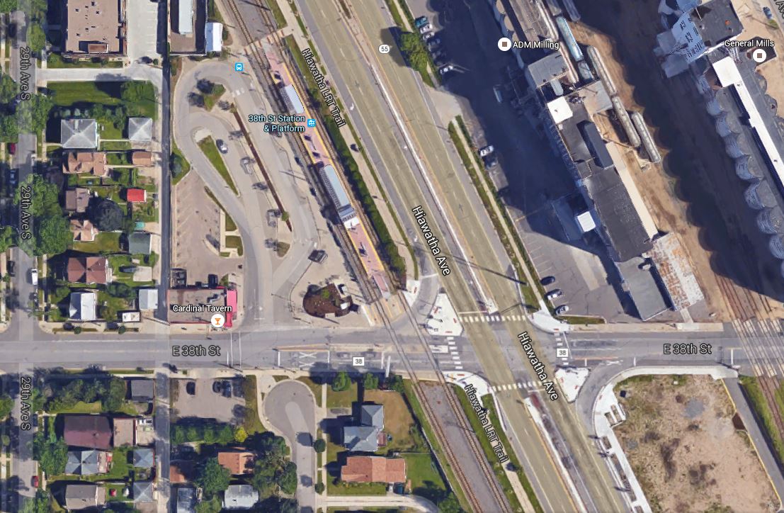
In this Google Earth view, Hiawatha Ave., with the LRT line paralleling it on its western edge, runs diagonally north-south through the center of the photo. The 38th St. LRT station can also be seen, while E. 38th St. crosses both LRT line and Hiawatha Ave. east-west, in the bottom third of the graphic. Note that Hiawatha and the LRT line intersect E. 38th St. at about a 60-degree angle, somewhat similarly to Airport Blvd and N. Lamar and the MetroRail Red Line in Austin. Photo: ARN, from Google Earth.


Leave a comment