
City of Austin’s Urban Rail (and “BRT”) plan
29 March 2013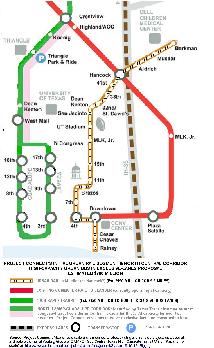
[Map: Dave Dobbs. Click to enlarge.]
♦
The map shown above has been rendered by Dave Dobbs from official maps, provided by the City of Austin (COA) and Project Connect, to show (as far as we can infer) what COA planners are proposing for their basic Urban Rail (using LRT) and “bus rapid transit” (BRT) starter system.
The 5.5-mile Urban Rail proposed route (downtown, through the UT East Campus, and Hancock Center into Mueller) is shown as a gold-ochre line with a pattern representing “tracks” in the center of it. The green line represents the proposed “BRT” route intended to serve the Lamar-Guadalupe corridor. The Red Line represents the currently operating MetroRail Red Line route.
This route plan can be compared with the 14.7-mile Alternative Urban Rail plan prepared by Dave Dobbs and Lyndon Henry — see map in right column. The details of the Alternative Plan are discussed in the previous article: An alternative Urban Rail plan.


Leave a comment