
Another possible design for light rail in Guadalupe-Lamar corridor » 12A_ARN_aus-urb-Triangle-WGuadalupe-NLamar_Google-Maps-screen-capture
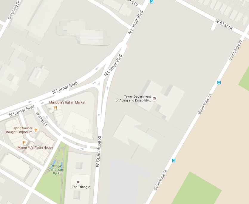
Map snippet shows West Guadalupe St. joining North Lamar at triangular land section now known as “the Triangle”. Graphic: Google Maps. (Click to enlarge.)


Leave a comment